He watched me brush my teeth like it was a TV show.
He said, “I might come talk to you later if that’s okay. It gets lonely out there on the road.”
But that was before he watched me brush my teeth. Sitting in his van in the driveway of his campsite.
I couldn’t see below the dash, but I couldn’t shake my suspicion of what was going on down there.
I try to make sure everyone has access to me at least twice a day. I put on my uniform, and walk around the whole campground doing things that take a long time.
I say hi to anyone who looks my way. I try to be very approachable.
As the season goes on, I become less amenable to being approached at my campsite.
This is my only private space.
He came back this evening, and looked for me way too aggressively. He must have called out “Hello?” 30 times.
I was super still. He walked around my tent several times, then walked away and started a car.
Whew.
I took out my phone, started playing a game, and leaned back in my chair.
“Hello?” Right behind me.
He re-parked his car and snuck up on me from a private path that cuts directly from my campsite to the restroom.
At this point, he must have had some sense of the fact that I was avoiding him on purpose.
He walked the perimeter of my tent so closely that he had to walk around each individual guy line.
He stopped in front of the obstacle course to my door and let out a frustrated sigh.
I was so scared he was going to unzip my tent. But I reminded myself, I have cameras in here, and there are lots of people around.
I stayed still. He stood at one end of my tent and looked deeply inside, trying to see a shadow move.
I’m sure he can’t see me in the center of the tent. I’ve checked. I’ve run experiments.
If he stood outside my tent much longer, maybe another camper would call the cops to report suspicious activity.
Am I being a terrible volunteer for thinking that the (extremely modest) campground fee does not include a date with me?
I try to be good at my job. I try to keep the bathrooms clean, I do my best at the lawn maintenance, I always try to use my customer service voice, I’m always on top of the reservations…
I understand what it’s like to be lonely. I’m so lonely it physically hurts. Sometimes I cry myself to sleep.
Of course I feel bad for old people. Of course I think that everyone should do their best to try to help other people.
But I’ve also had so many people choose not to help me or to walk away from my case or whatever. I honestly feel a little entitled to do the same sometimes.
I don’t love hanging out with single old men. I know a lot of women my age do. A lot of women my age think that old men are harmless and adorable.
I’ve just had too many bad experiences.
I’m not trying to be a bad ranger. But this man getting so close to my tent feels like a big red flag to me.
I feel like he’s showing me how entitled he feels to come into my private space and walk directly over my clearly laid out boundaries.
It’s not all men. There’s another single man the same age camping here who I’m getting along with. He left me a note this morning, and it made me smile.
He’s a windsurfer. He seems innocent to me. Maybe because he’s always on the go. Maybe because he’s never come within ten feet of my tent.
It’s the loneliness and air of desperation that really scare me.
Just because I also feel loneliness shouldn’t obligate me to console this lonely man.
Two wrongs don’t make a right.
(Right?)
There was this night in Yosemite, maybe about a year ago.
I was sitting in the kiosk in the dark at midnight with my head on the journal when M came in.
She was the midnight bear ranger. She came to my kiosk looking for a private space.
“I have to tell you something,” she said.
A tourist started knocking on the window.
We ignored them, but they wouldn’t let up.
M rolled up the window fast, slamming it open.
“Is this an emergency?”
“No, we just want to check in.”
“Do you see how the blinds are all closed and the lights are all off? That means no one is home.”
She slammed the window shut and said, “Sorry.”
So, I shouldn’t feel bad about just ignoring someone every once in a while, right?
One of the hardest things about being unhoused is the lack of privacy.
And that hasn’t really changed.
I got whacked in the eye by a branch this morning. Like, directly in the eye.
An unhoused person had driven through a barrier I had set up to a closed off area, so I decided to roll some logs uphill to create a new barrier.
One of the logs rolled over a branch in such a way that the branch just flew instantly and directly into my eye.
It hurt really bad, even after I napped, took 2 Tylenol, and showered. And it triggered my PTSD pretty badly to feel punched in the face like that.
So I just wanted to be alone. And everyone came looking for me.
The family who I wrote a note to asking to put their fire pit back in order, decided to raise hell instead.
“Excuse me. EXCUSE ME. HELLO. ANYONE HOME?”
Then they came back and said, “Housekeeping!” That one actually kinda makes my blood boil. It’s like the equivalent of snapping your fingers at me while I’m waitressing.
I don’t think of myself as Housekeeping. I think of myself as customer service. But now you won’t be getting any of that.
I ignored them and pretended not to be there.
So they decided to bring their kids down to ride bikes in my driveway for literally about two hours.
They tried to call for me at least six times. I felt like they were stalking me. (There is a number posted that they can call if I’m not there.)
I was thinking, these toddlers are gonna have to pee at some point. I know I do.
The second they went to the bathroom, I bolted to my car with my shower bag.
But before that happened, the ranger and law enforcement both came looking for me, too.
And while it’s possible that they might have been there to support me in some way, I was already triggered and having a ranger show up unannounced just made it worse.
I know that sounds weird, cause I want to be a ranger. But I’ve had some really bad experiences with cops in the past. I’m not sure if I’ll ever get used to interacting with them like it’s normal.
I once had a cop tell me he’d take my baby away if I called 911 on my ex beating me up, and I’m now estranged from that child in real life.
So maybe the law enforcement officer didn’t mean to scare me or trigger me or make me double over in tears in the shower. But she banged on my whole tent and yelled my name and yelled ‘law enforcement!’
Also, I had just been smoking. What do you do when law enforcement walks into your fresh weed cloud?
Play dead and pretend not to be home is what I did.
Why can’t they just give me like a fifteen minute warning?
There are two campgrounds named ‘Peninsula Campground’ in Northern California.
Most locals probably know about the privately owned campground near Rollins Lake. They are somewhat infamous on Yelp.
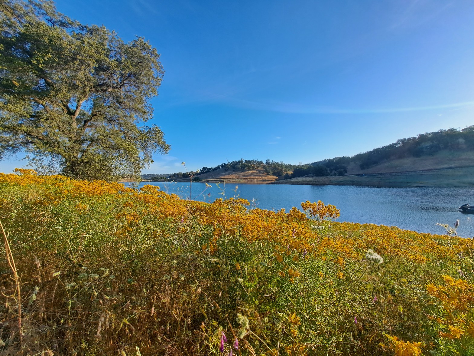
This review is about the other, perhaps lesser known Peninsula Campground– the government-owned Peninsula Campground, which is part of Folsom Lake SRA (State Recreation Area).
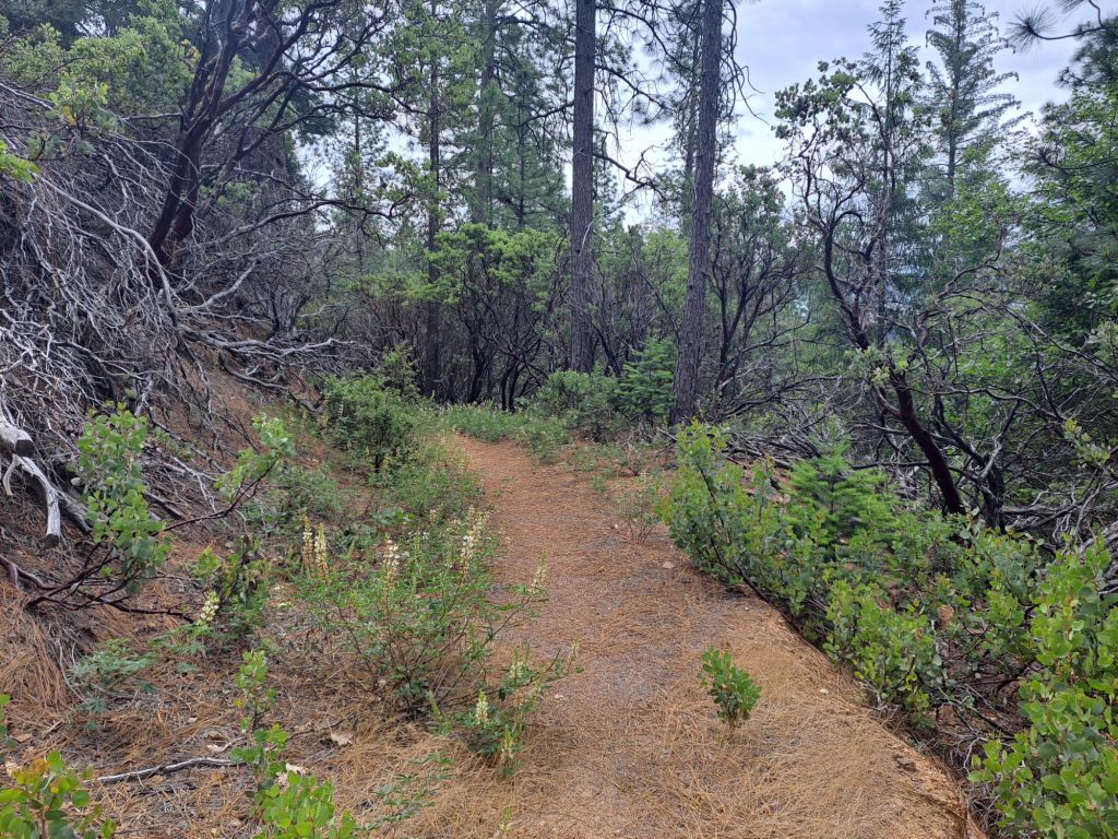
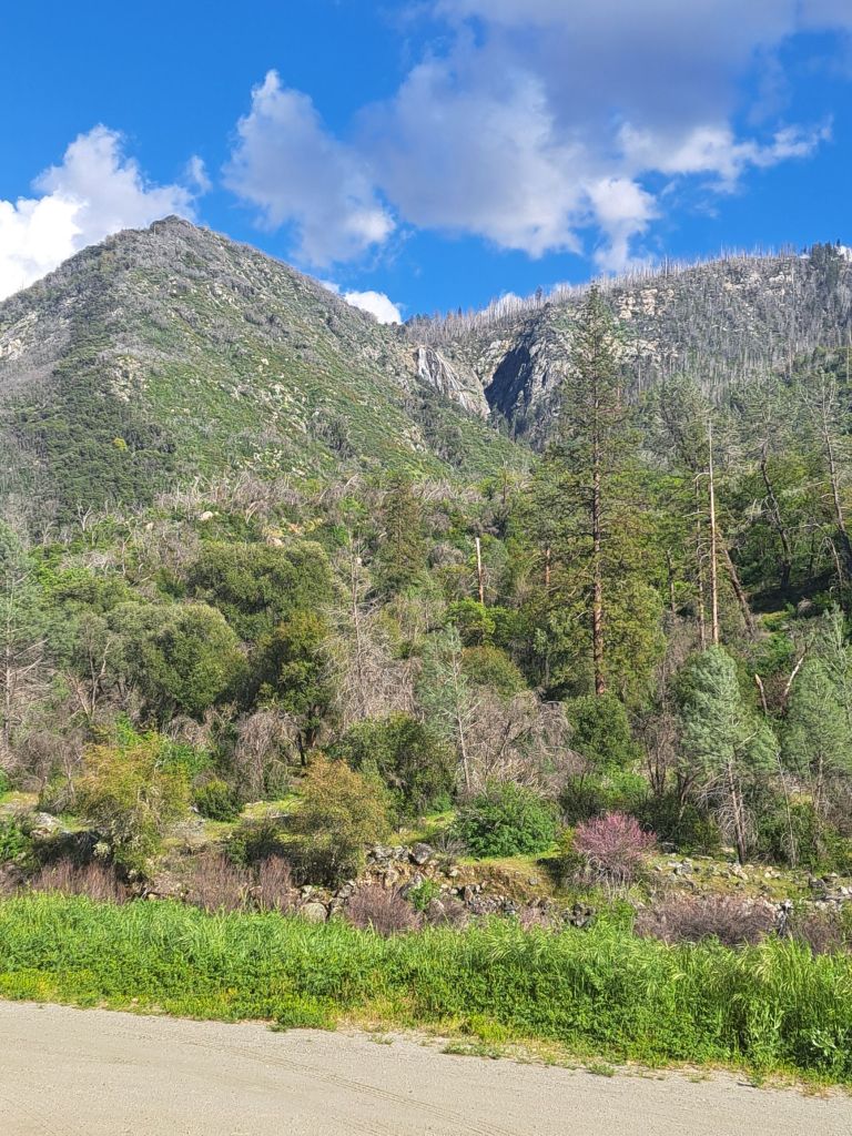
Peninsula behind the Ravine as seen from the Oaks Nature Trail
It’s located adjacent to a prominent peninsula on Folsom Lake, which is actually closer to Pilot Hill than to Folsom.
Driving from Folsom, the directions to Peninsula are fairly straightforward. Take Salmon Falls Road all the way to where it ends at Rattlesnake Bar, and then take Rattlesnake Bar all the way to its end at the campground.
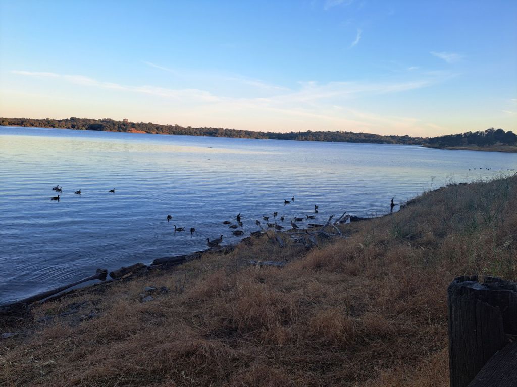
Geese with goslings in Folsom Lake
From a boat, it’s even faster– my friends said it only took them a few minutes to boat to me from Beals Point, but the drive takes nearly an hour.
There are two boat ramps at Peninsula: one in the day use area, and one in the campground area (for registered campers only). Both are listed on Google maps.
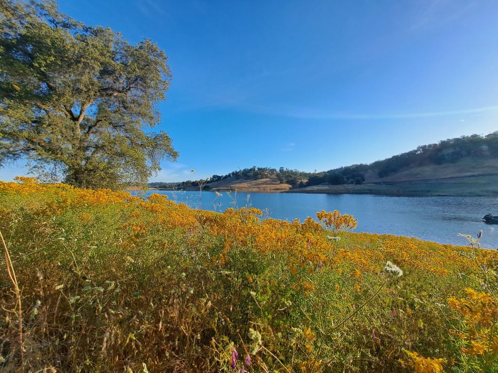
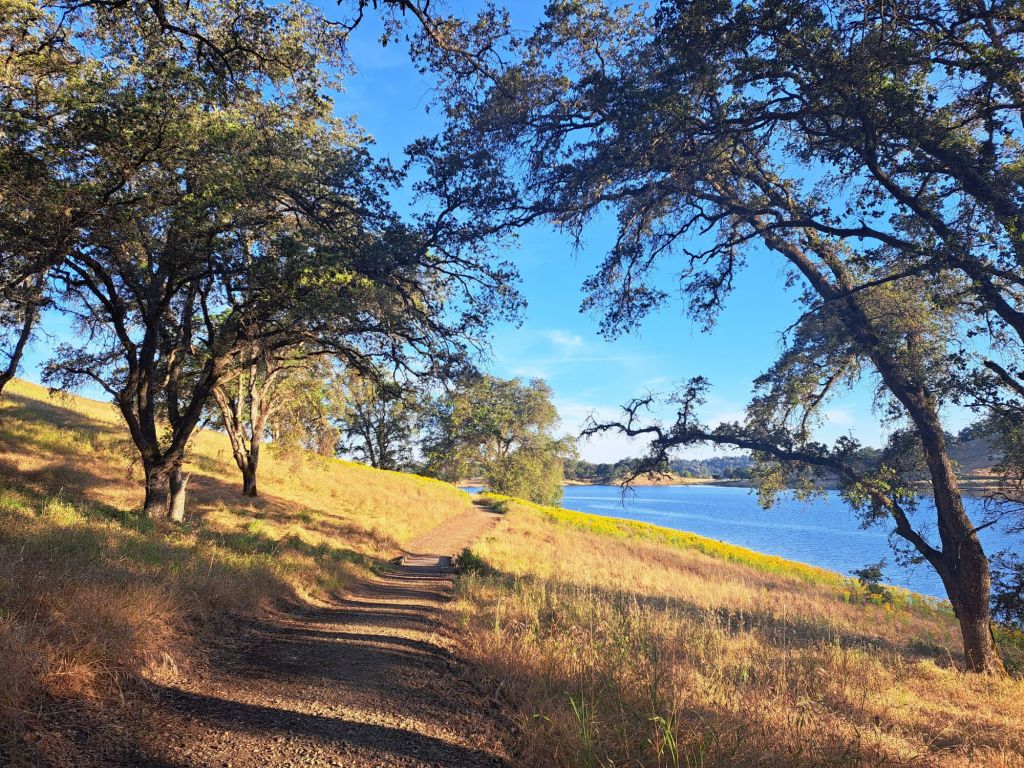
Oaks Nature Trail and Folsom Lake
Registration at Peninsula has been the easiest of any campground I’ve stayed at so far. Trips that are at least two days out can be reserved online.
If there is space in the campground, then same-day camping is permissable.
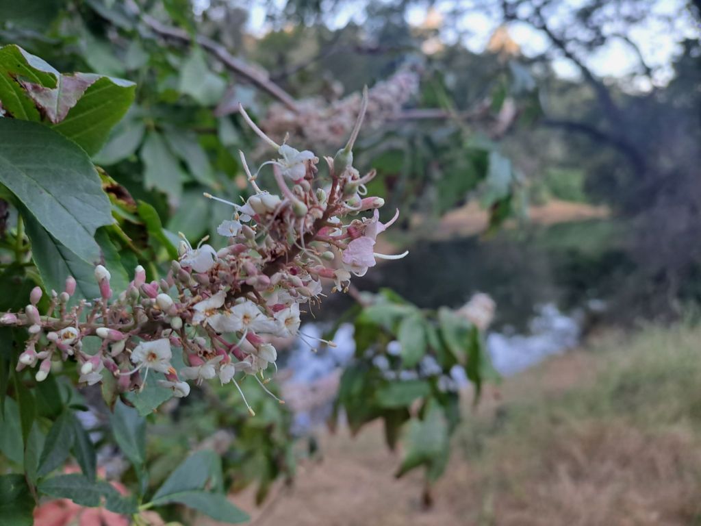
Blooming buckeye on Oaks Nature Trail
I find it easiest to register with the camp hosts at the kiosk, but there are also self-service envelopes for those who arrive after hours.
Park rangers patrol the campground at all hours. They are not strict about noise, but they are super strict about smoking and drinking outside of the campsites.
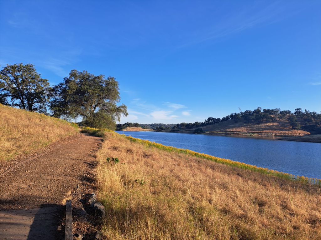
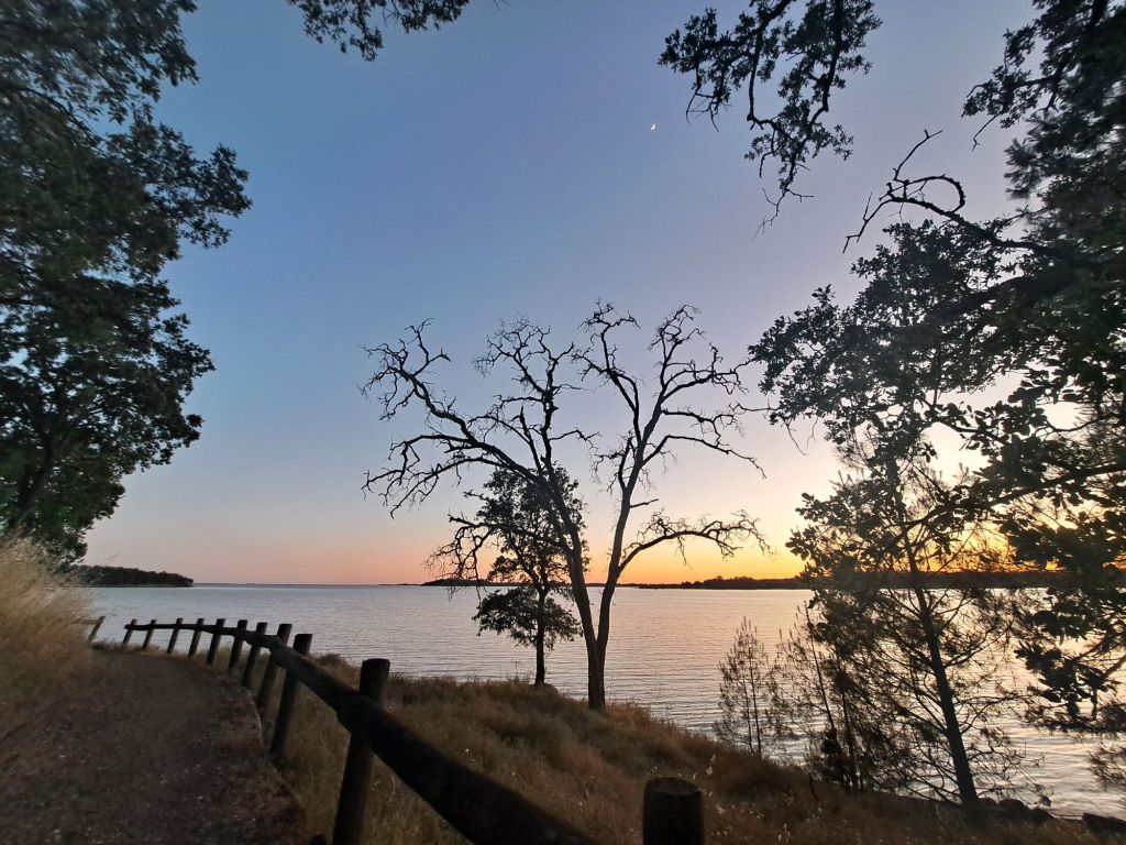
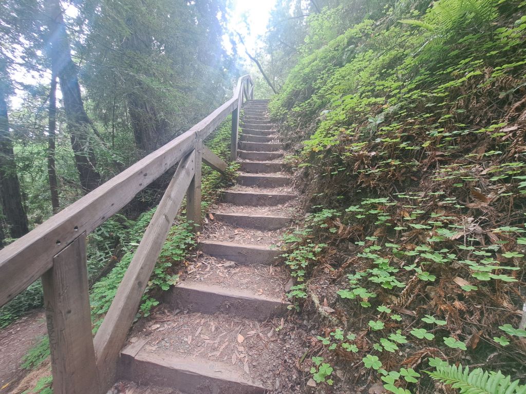
The Oaks Nature Trail at Sunset
Great hiking trails in or near the campground include Oaks Nature Trail, Darrington, and Salmon Falls.
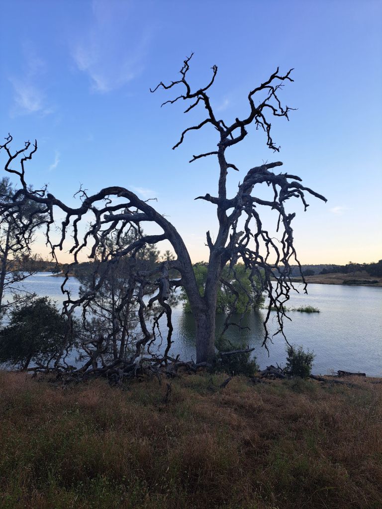
The Oaks Nature Trail is only one mile long, and is located entirely within the campground. It’s mostly shaded, and follows the outer edge of the peninsula through oak woods.
A very, very old oak tree seen from the Oaks Nature Trail
Several longer, better hikes are just a short drive away, down Salmon Falls Road.
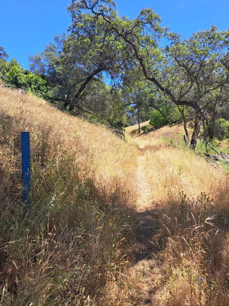
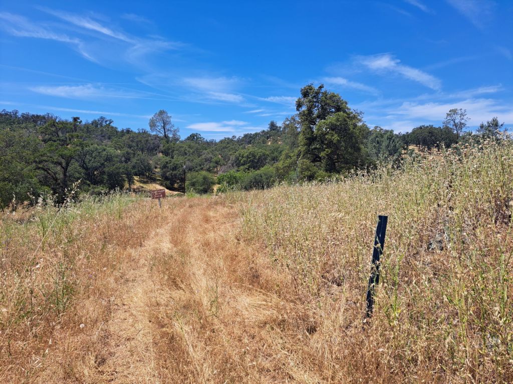
Darrington Trail can technically be accessed from the campground, just across from the kiosk.
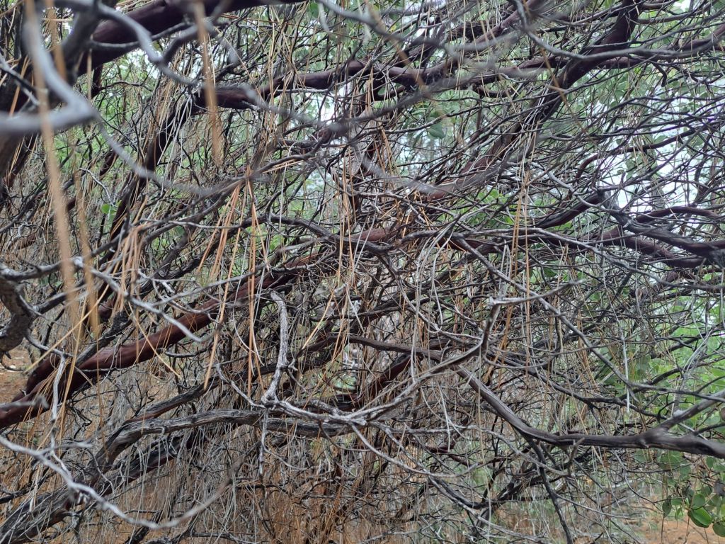
Blue trail marker on overgrown side of Darrington Trail
However, this side of the trail is wildly overgrown with tall grass, and is chalk full of ticks and rattlesnakes.
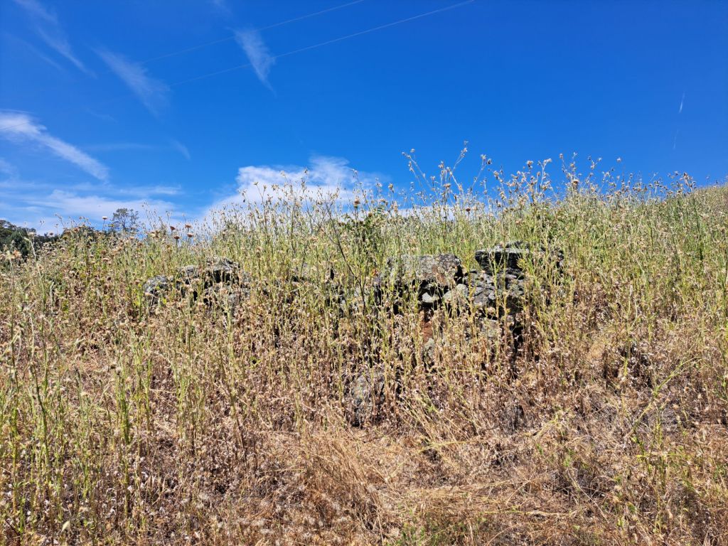
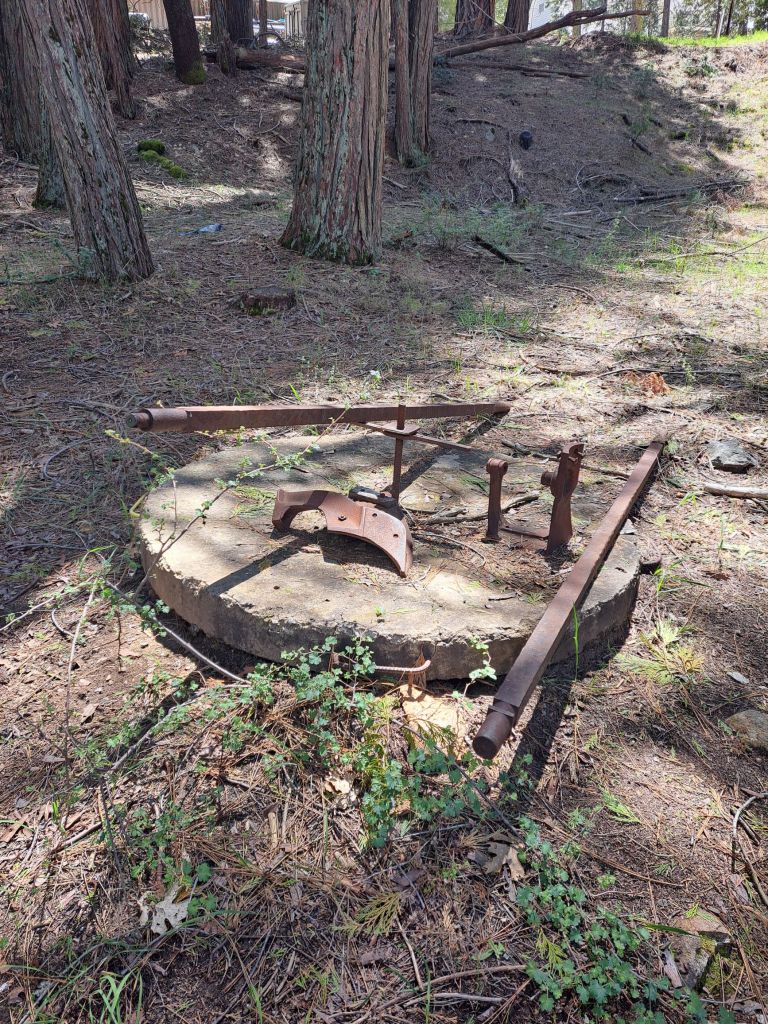
Rocks that look like they may be the ruins of a gold miner’s cabin
Most of the time, it’s practically impossible to tell if/when you’re stepping on some kind of nest.
Tall, unkempt grass on Darrington Trail
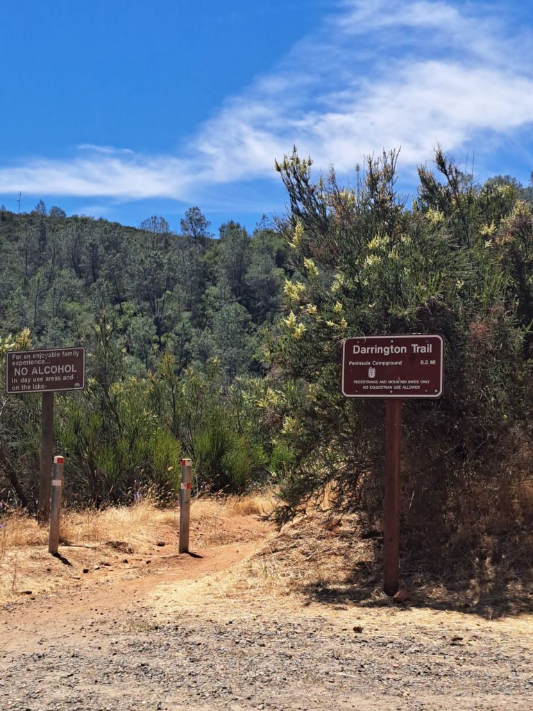
So, if you’re able to, and if you’re not dead set on hiking the entire 8 miles, I would suggest taking Darrington from the other entrance, which is located down Salmon Falls Road.
This side is much more nicely maintained, is more shaded, and has better views of the lake.
Darrington Trail head at Salmon Falls Road entrance
Camping fees at Peninsula include day use parking at any California state park. Just make sure your pass is visible in your window before you leave your car.
The Salmon Falls Road entrance for Darrington is also close to several other great hiking trails, including the South Fork American River trail, which is one of my favorites in the area.
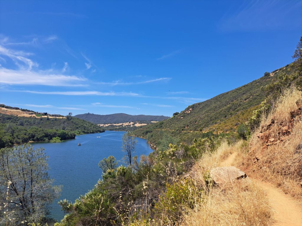
Darrington Trail
I only had time to hike the first few miles of Darrington, but I loved it. I definitely want to come back to finish it when the weather is cooler.
The views are similar to the views from the South Fork or Brown’s Ravine trails, but not exactly the same. Each trail features unique flora.
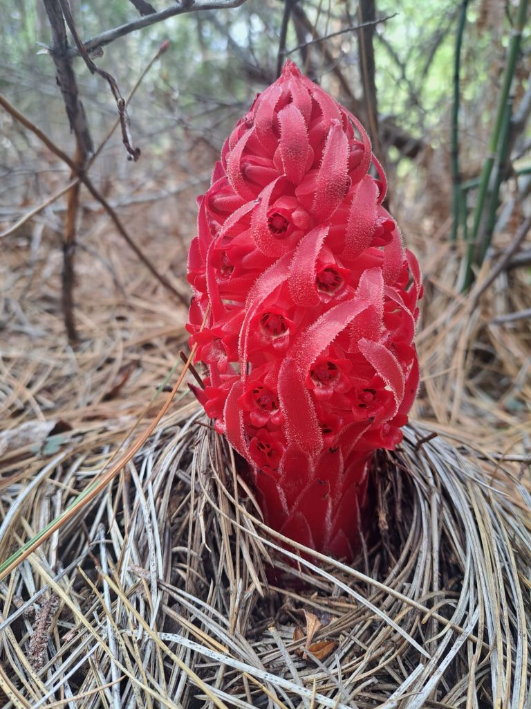
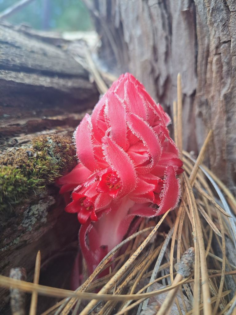
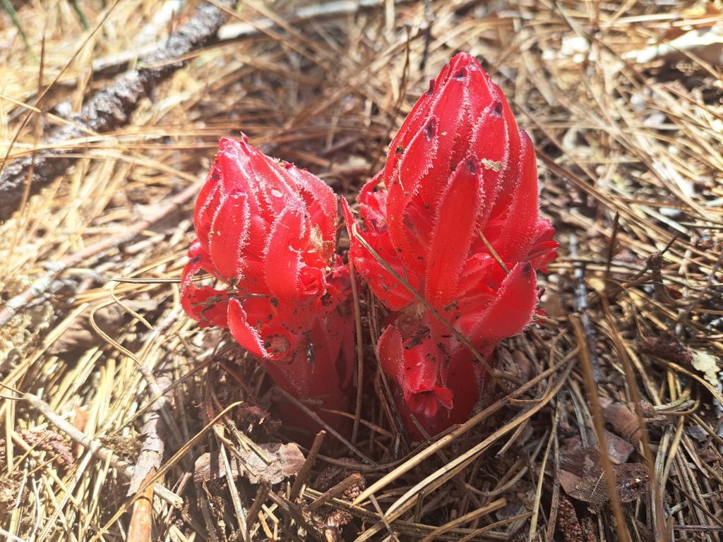
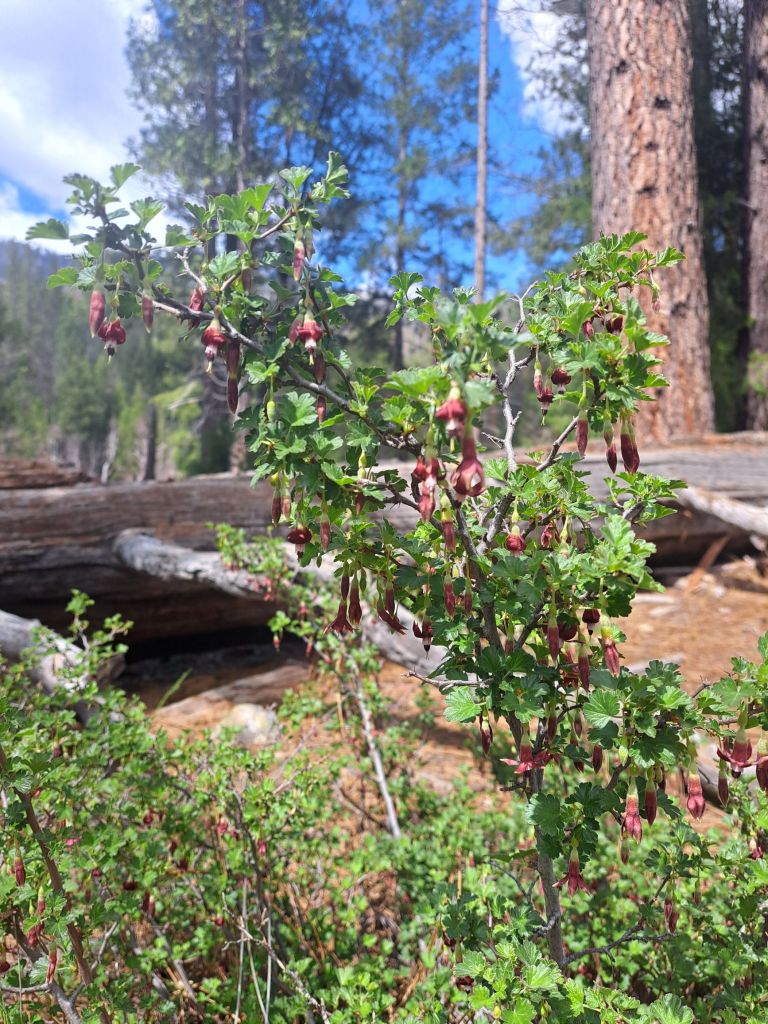
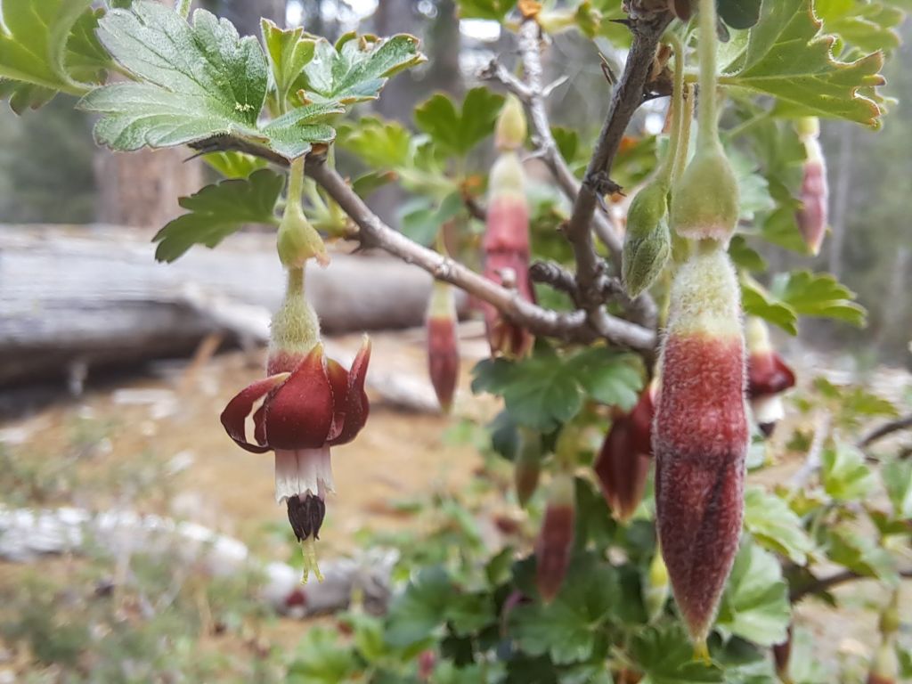
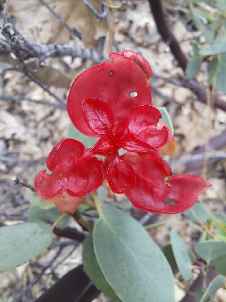
For example, on Darrington, I saw some shrubs I’ve never seen anywhere else before. They were blooming with tiny red and yellow flowers.
Shrub with red and yellow flowers on Folsom Lake
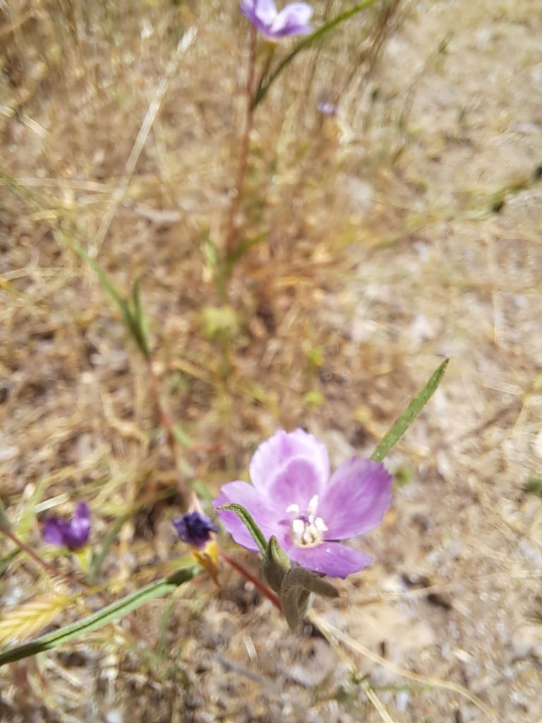
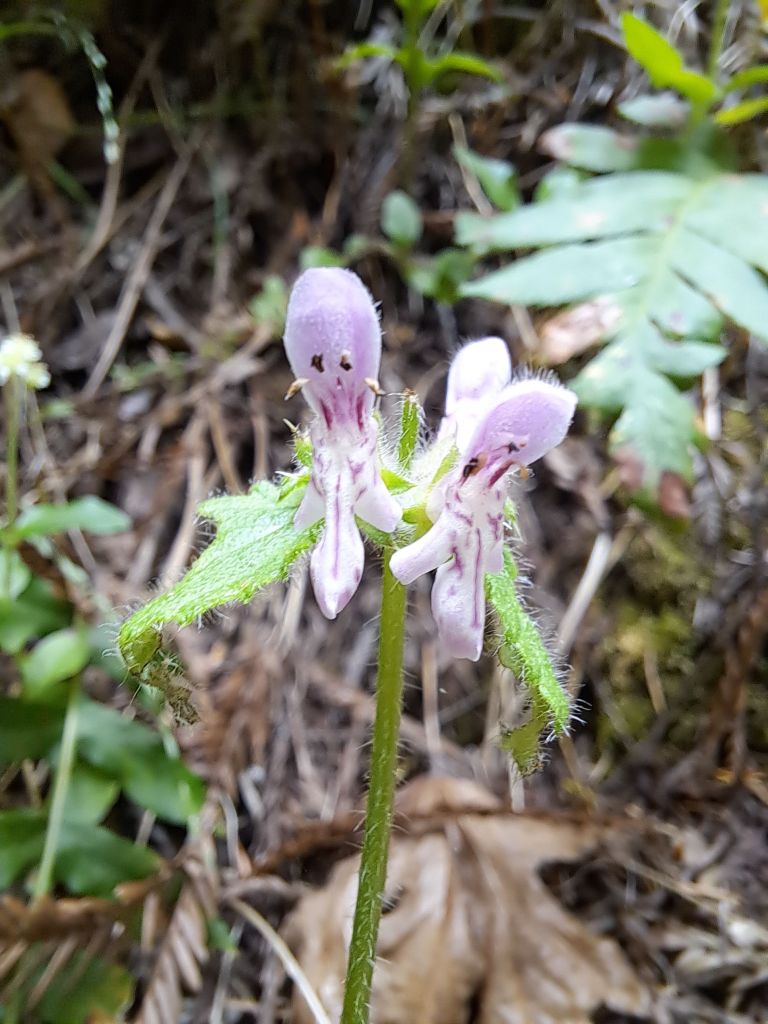
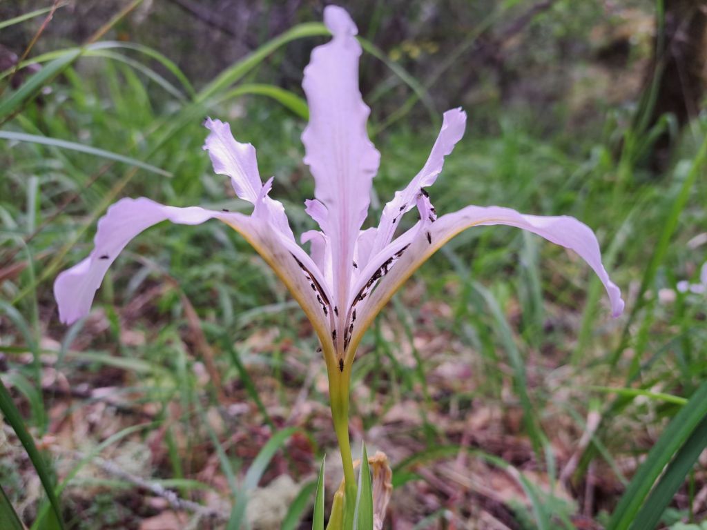
On the other side of Darrington, I found some Sierra Checkerbloom.
Sierra checkerbloom on Darrington Trail
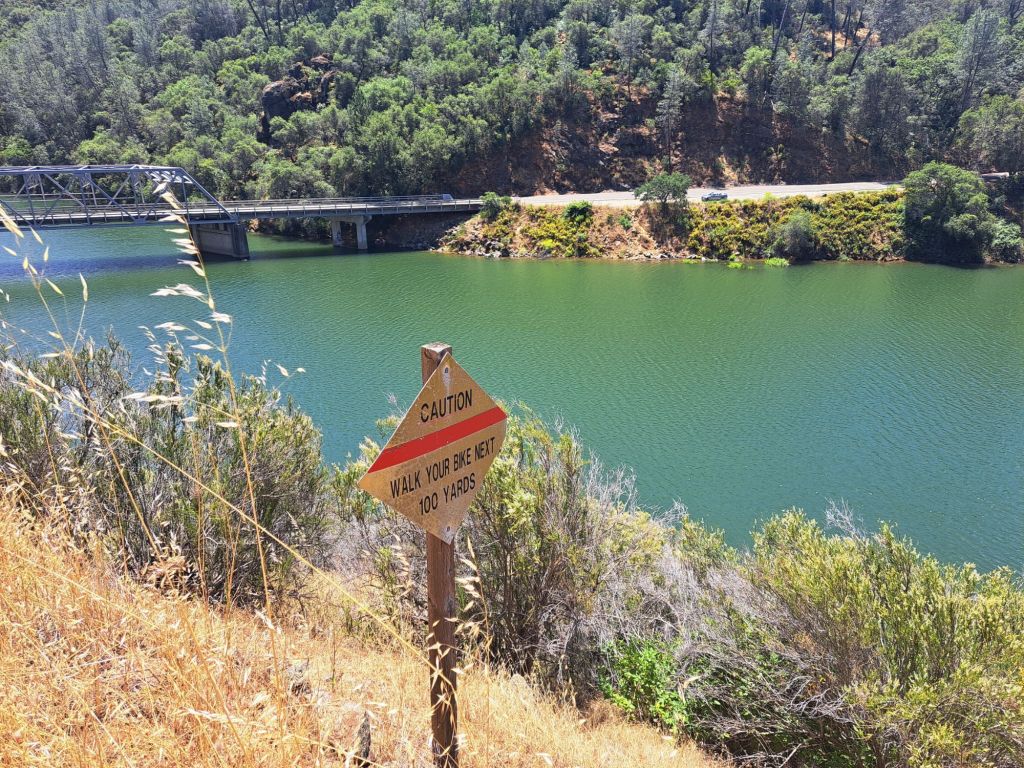
I thought this sign was funny. It would not be fun to fly off this cliff on a mountain bike.
Sign that says ‘Caution: walk your bike next 100 yards”
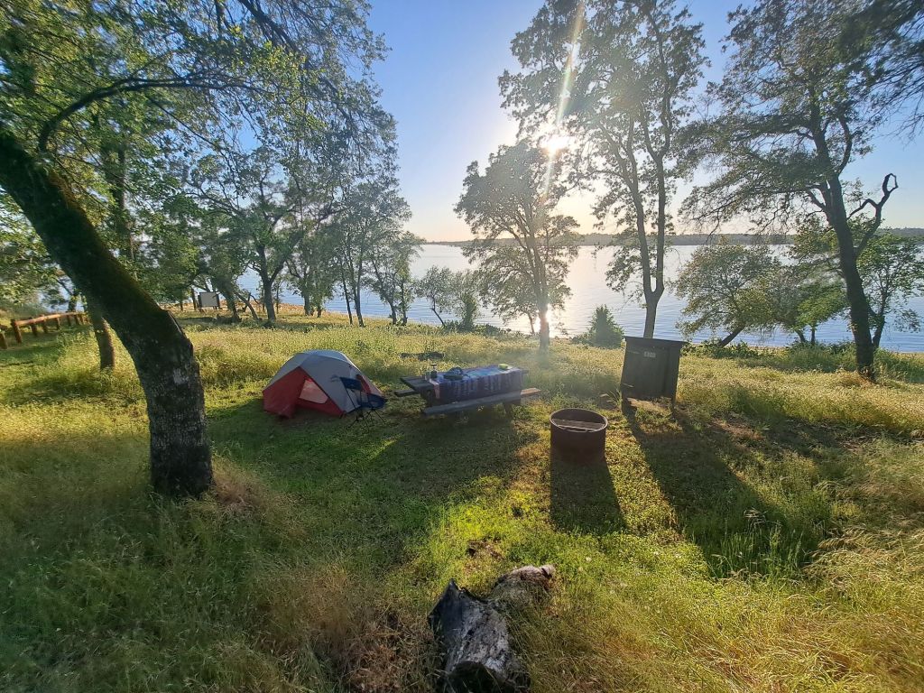
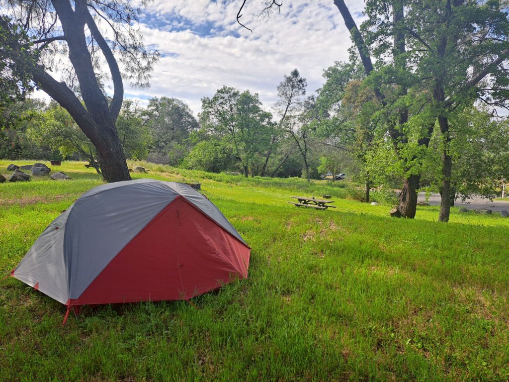
Each of the campsites at Peninsula are unique, and I had the opportunity to stay at several of them.
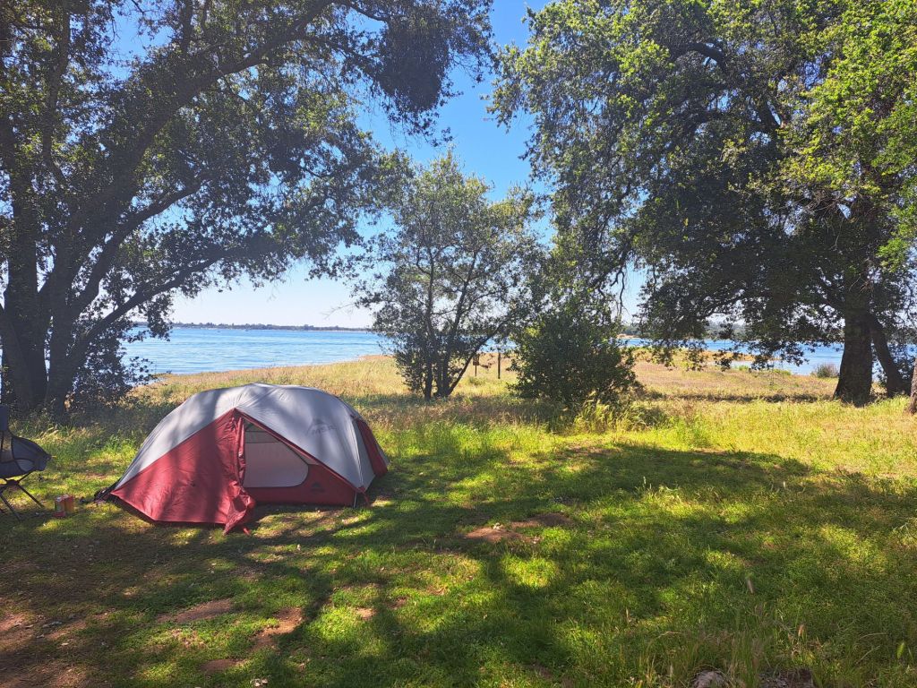
Campsite 80
The first site I stayed on was 80, which I’d hand-picked after driving through the campground. I thought it looked like the most ideal spot, since it was the closest to the lake.
Campsite 80
It was absolutely gorgeous, and, if you don’t mind noise, then I would highly recommend this spot.
On the other hand, if you are even a little bit sensitive to noise, I would pick a different spot.
View from my tent window at campsite 80
What I didn’t realize was that this site is on the edge of the boat mooring area. People come here to park their boats and chill.
Some of them peed right in front of me, not realizing that I was only about a hundred years away.
On the night of Mother’s Day, a group of college aged kids camped on spot 79, which is so close to 80 that they may as well be the same spot.
They were clearly camping pros– they had all kinds of expensive equipment, including a Jackery with huge solar panels.
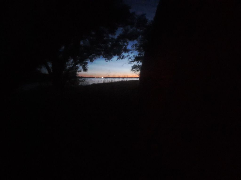
Sunset at campsite 80
It was peace and quiet until 10pm, which, ironically, is when quiet time starts. At this time, they began blasting horror movies from a movie projector which they had set up several feet away from my tent.
Sunset from my tent window at campsite 80
Rather than asking the rangers to ask these kids to quiet down, I asked to be moved to a different site.
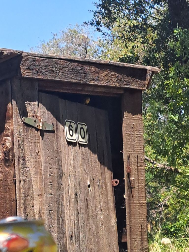
Campsite 60
I had noticed that my first choice spot, spot 60, was unoccupied and unavailable on the website. Upon inquiry, I found that it was an overflow “buffer” spot reserved for campers with issues.
The rangers were more than happy to move me to site 60. They didn’t give me any grief about it at all.
Looking down on site 60
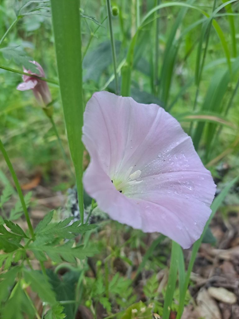
But, site 60 turned out to be wildly overgrown with baby lupine and golden poppies. I felt terrible stepping on them, and it was hard not to.
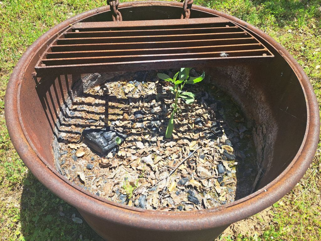
The broken raccoon box at site 60
Plus, the raccoon box was entirely broken, and there was a healthy little sapling growing in the fire pit.
A sapling growing in the fire ring at campsite 60
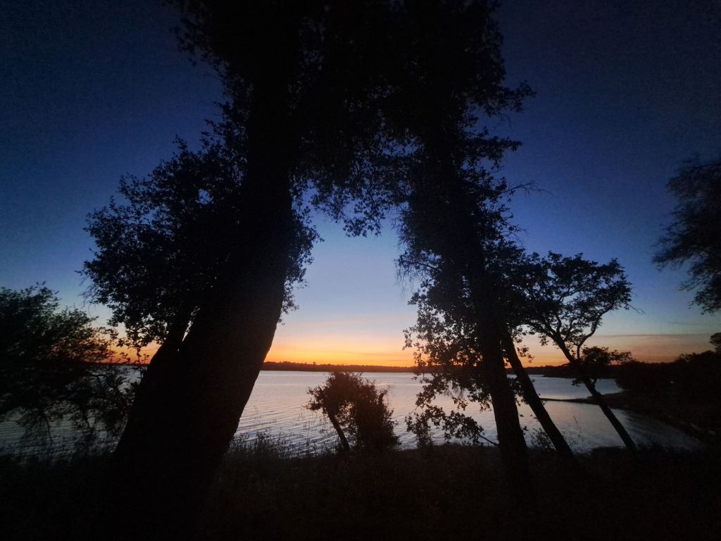
So, the next night, I switched sites again, one site over, to spot 59. Apparently, I failed to take pictures from this site, but the views are almost exactly the same as from spot 60.
Sunset view from site 60
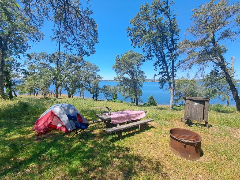
The next time I came back to Peninsula, I ended up on spot 20, because it was the only one available!
I was lucky to get a spot at all, since it was Memorial Day Weekend.
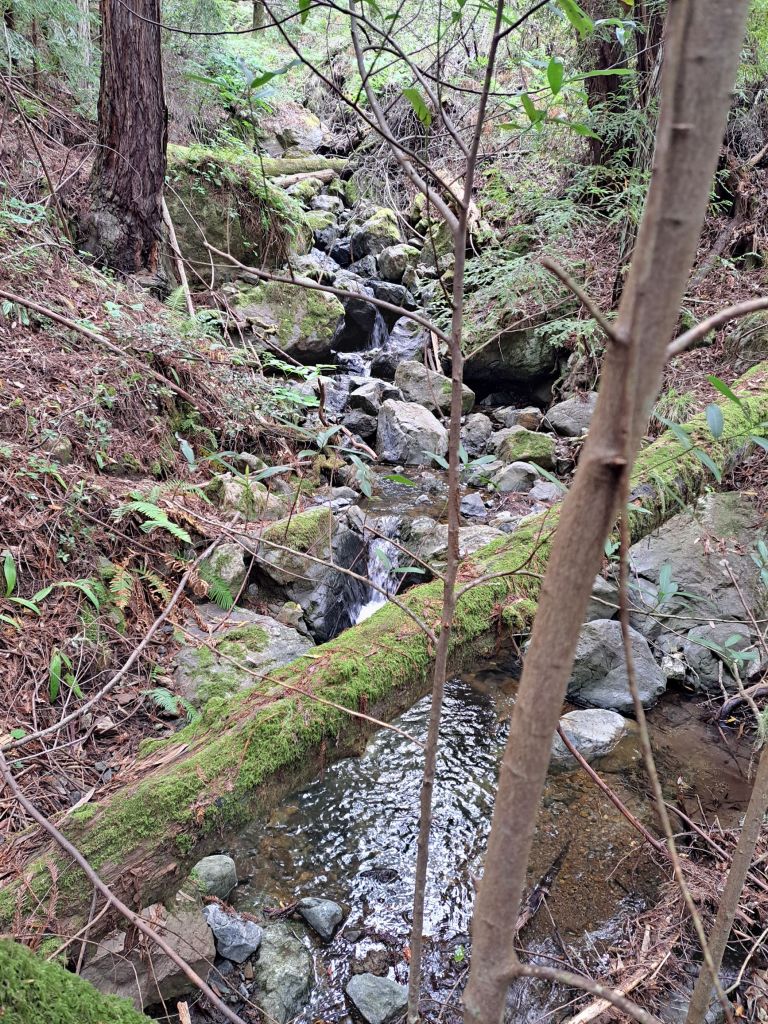
Site 20 turned out to be my favorite one so far. It’s set off kind of by itself. I was just above the Oaks Nature Trail, on a cliff by a ravine.
Buckeye bloom on the Oaks Nature Trail
The ravine was full of salmon, which made the area a hotspot for quiet early morning fishermen.
The salmon themselves were unbelievably noisy.
My first night at Peninsula, I almost thought someone was dumping bodies in the water 😂
Oaks Nature Trail and Folsom Lake
All throughout the night, at least once per every few minutes, I could hear a salmon jump.
They like to jump up to six feet in the air, and then flop down on their full side, which creates a loud splash.
(Apparently, scientists think they do this to dislodge body lice.)
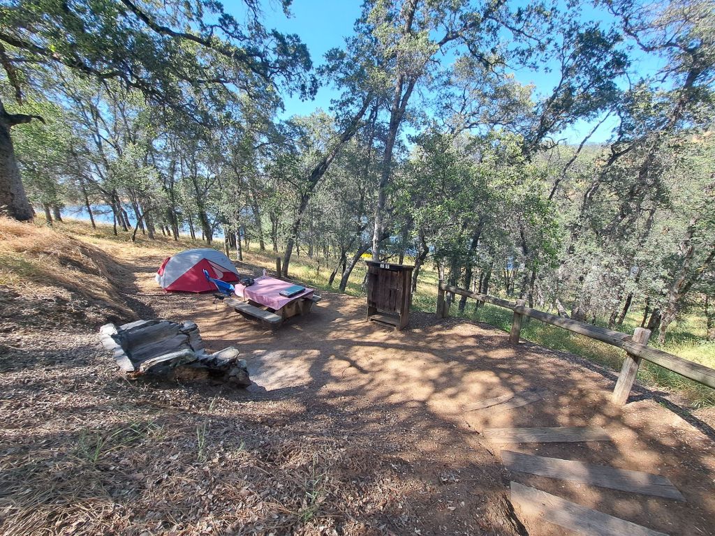
Site 20
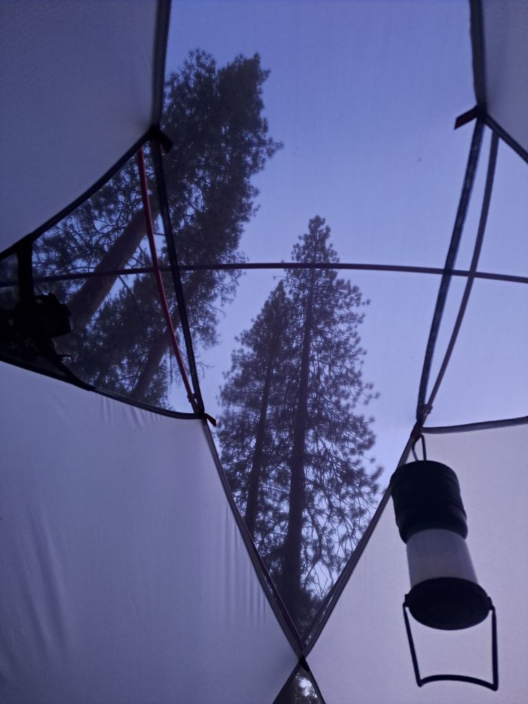
I had read in another review that the upper loop of the campground doesn’t have good views of the lake, but that’s just not true. I loved my view from Site 20.
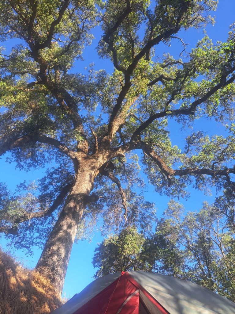
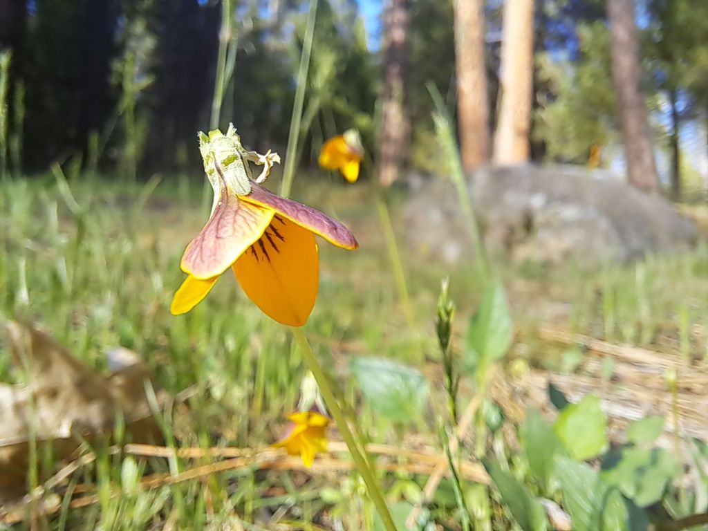
Due to being directly underneath a huge blue oak tree, this site was mostly shaded for most of the day. It was right above a yellow wildflower bloom, which the herons seemed to love.
The giant oak tree looming above my tent at site 20
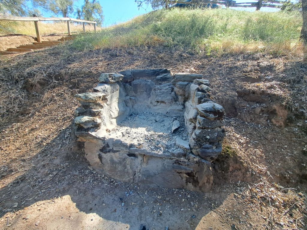
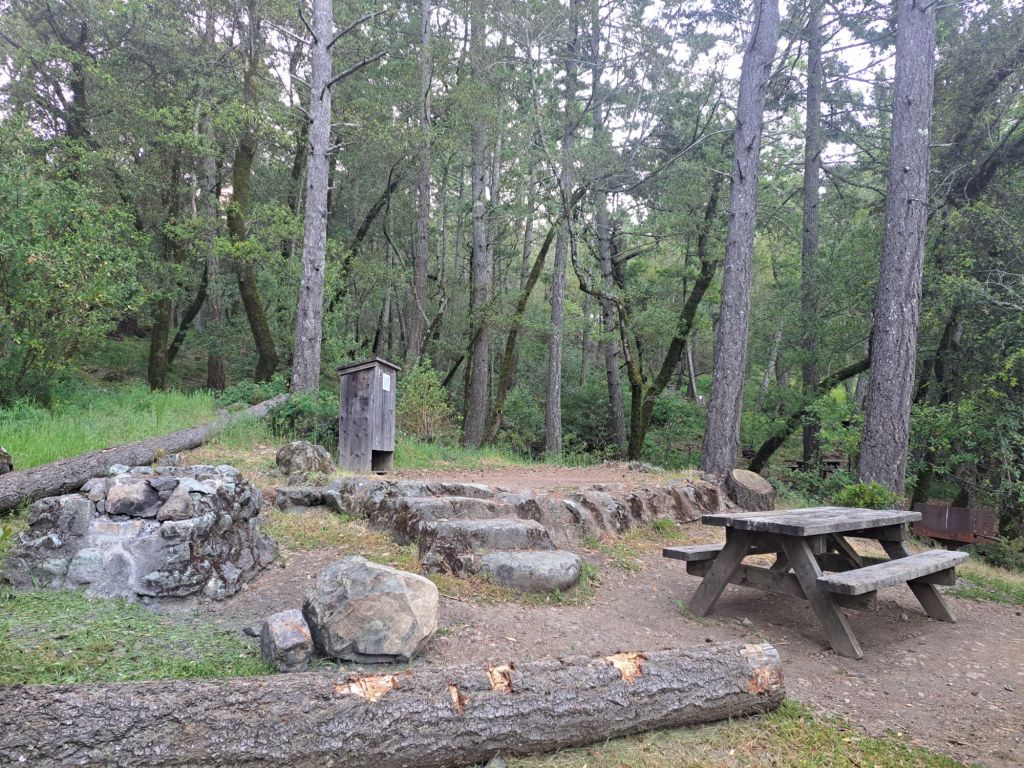
To compensate for being slightly further away from the lake, most of the upper spots have beautiful stone grills. Some of them are falling apart, but they still work.
The stone fireplace at site 20
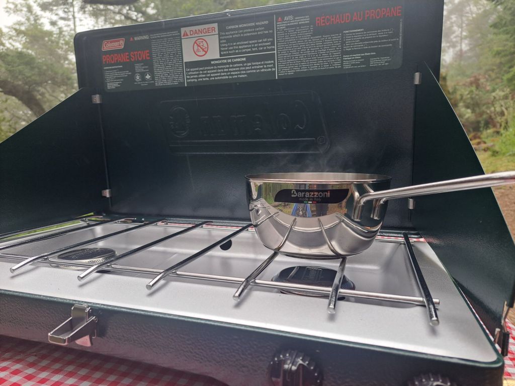
I didn’t use my stone fireplace, but I did use my camp stove to up my outdoor cooking game, from boiling water, to boiling things in water.
I had picked up some of my favorite ravioli from Trader Joe’s, which I had for both dinner and the next day’s breakfast.
Upping my cooking game at site 20
After a few nights, someone else reserved spot 20, so I moved to spot 47. But, whoever reserved spot 20 never even showed up.
Spot 47 was my least favorite. It was super sunny, and everyone driving in or out had to drive by that spot.
To make matters worse, this site seemed to be a deer’s home. He marched loudly through my site in the middle of the night, and stole some trash that I had forgotten to put away.
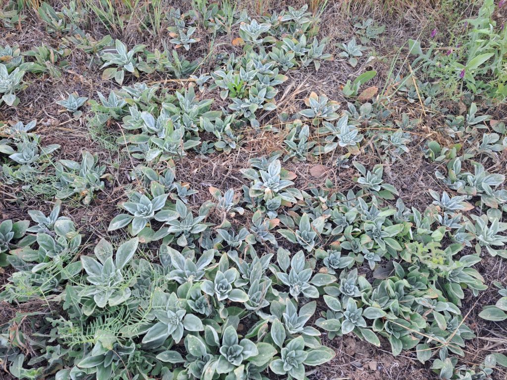
Native ground cover succulents on the Oaks Nature Trail
Once the temperature started rising above 80 degrees, I had to go. It gets hot in a tent really fast.
I packed up early in the morning, and headed back to the mountains.
I think of Beals Point as my “home campground,” since it’s the closest campground to where I lived in Folsom for fifteen years.
ADA Site #1 at Beals
It’s also one of the first places I ever went camping outside of Yosemite, although I never camped there during the entire fifteen years that I lived there as an adult.
Recent circumstances made it convenient for me to spend a few nights at Beals.
There have been times that I’ve had to come into town to check my mail or get things from my storage, and it’s usually easier to just spend the night in Folsom before I take off to my next destination.
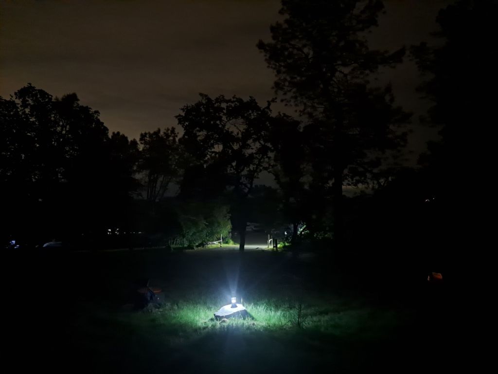
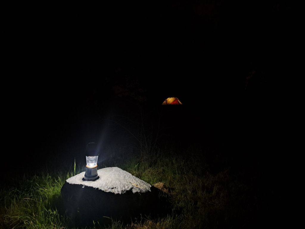
Duracell lantern from costco
Beals Point is a very large campground, but it fills up quickly. It’s not uncommon for weekends to sell out far ahead of time, even during the “off” season.
As compared to other state campgrounds, the sites here are large and private.
There is some variation from site to site, but the online pictures are fairly accurate.
I may be biased, but I think it’s a beautiful area. The campground is located right on the edge of Folsom Lake, but is still close enough to town to make an emergency trip to Walmart if you need to.
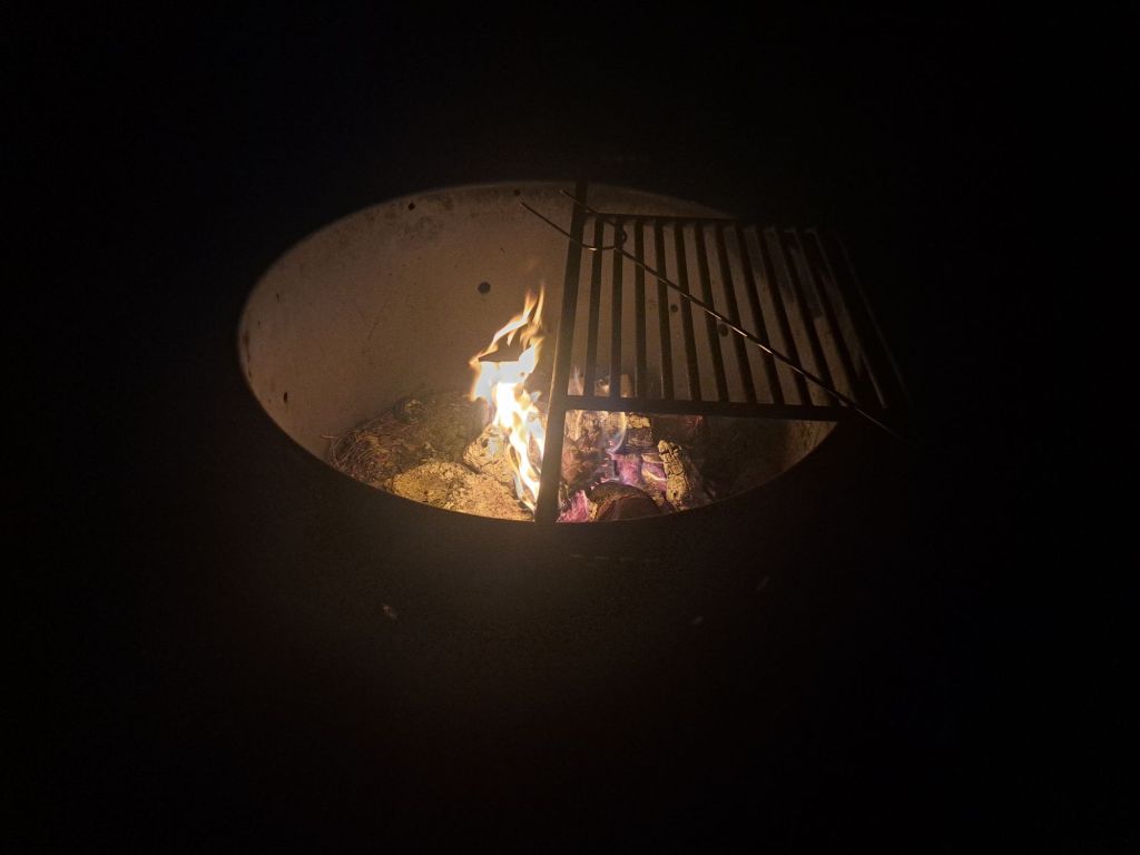
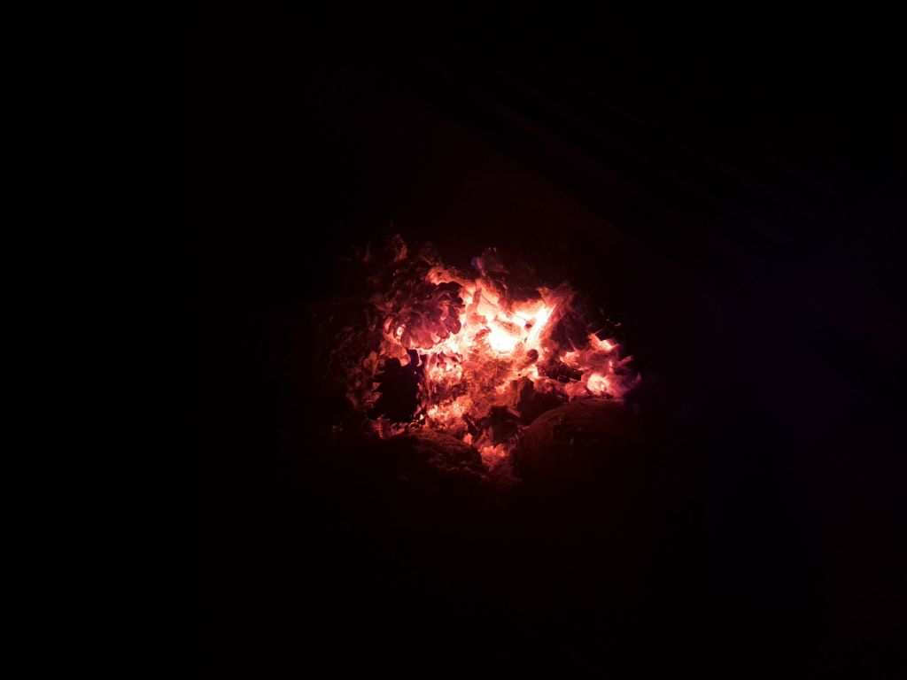
Fire
Folsom Lake is very popular for boating, camping, and hiking. You can also kayak or paddle board, although it would be safer to do these a few miles away at Lake Natoma.
Beals Point serves as the terminus for the American River Bike Trail, which is one of the longest and most famous bike trails in the world.
The trail runs thirty two miles along the American River from Folsom to Old Sacramento. It’s also possible to continue on riding to Davis or San Francisco.
Site 1
I’ve personally ridden about 20,000 miles on that bike trail, so, you can see why I’m having trouble moving on 🤣
It is common to see deer, coyotes, bobcats, rattlesnakes, king snakes, bunnies, western gray squirrels, blue skinks, skunks, hawks, herons, and bald eagles along the trail.
The sites at Beals Point are pretty standard, with picnic tables, fire rings, and bear proof trash receptacles nearby. Most offer partial shade.
If you are looking for a more private or quiet site, I would recommend staying near the camp hosts or amphitheater. The sites closest to the lake are known for partying.
Site 1
This campground is better patrolled than most. Either that, or the Folsom Police are watching me 🤣 Every single time I’ve stayed at Beals, I’ve noticed a heavy police presence.
There are showers at Beals, for a fee. I believe it’s either 4 quarters or 1 shower token (which can be purchased from the kiosk for $1) for five minutes.
Technically, I’ve used the showers at Beals, but it was over twenty years ago. All I can remember is that I kept asking my mom for more quarters.
The bathrooms are not terribly dirty, although they are full of bugs, and do not have soap dispensers.
Site 1
As much as I hate the town of Folsom, I actually love this campground. It’s wild and rustic, the fees are reasonable, and the staff is great.
Like most California State Parks, sites can be reserved online two days ahead of time. Sites that are not sold online can be sold in person on a first come first serve basis.
In the rare event that there are still sites open after the kiosk has closed, self registration is possible.
Fire is allowed at Beals, as long as you purchase your wood in Folsom. Bringing wood from other forests is said to transmit pests which threaten native trees.
Fire
Firewood can be purchased at the ranger station for $10/bundle. Gathering firewood from the campground is prohibited.
When I read that Mineral Bar was a first come, first serve campground, I immediately wanted to check it out.
Day use area
I was hoping to find something similar to Bootjack Campground in Mount Tamalpais. What I found instead was an absolute mess.
According to the website, there would be self pay, first come first serve campsites. Additionally, there would be a kiosk staffed with a ranger.
When I arrived to the campground, it was almost completely empty. Only two other spots were occupied.
Campground sign
But, a busy weekend was coming up, so I wanted to secure my spot as early as possible.
I was hoping to prepay for at least a few days, so that I could leave early in the mornings to go hiking.
There was no ranger at the kiosk. A sign on the window said, “online reservations only.”
New Zealand mud snails
The problem?
Reservecalifornia.com locks most campsites 48 hours ahead of time. I couldn’t pay online for a campsite for the same day.
Even though the entire campground was empty, the sites were locked on reservecalifornia.com
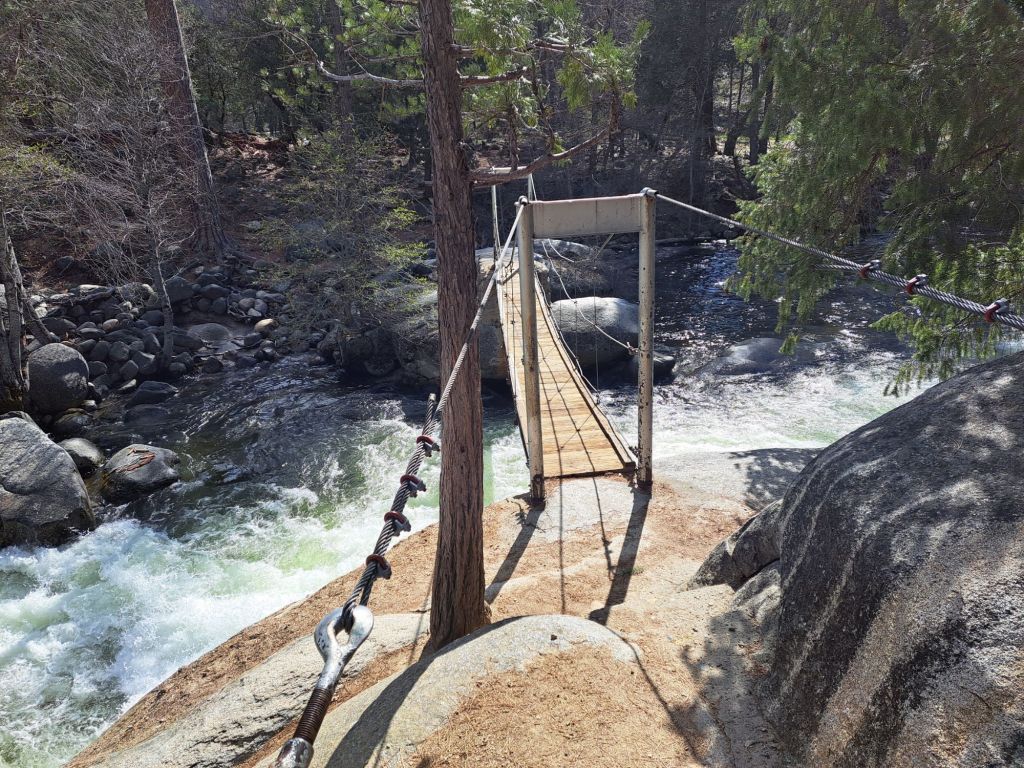
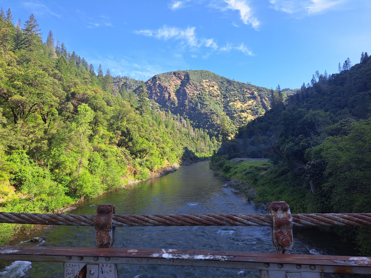
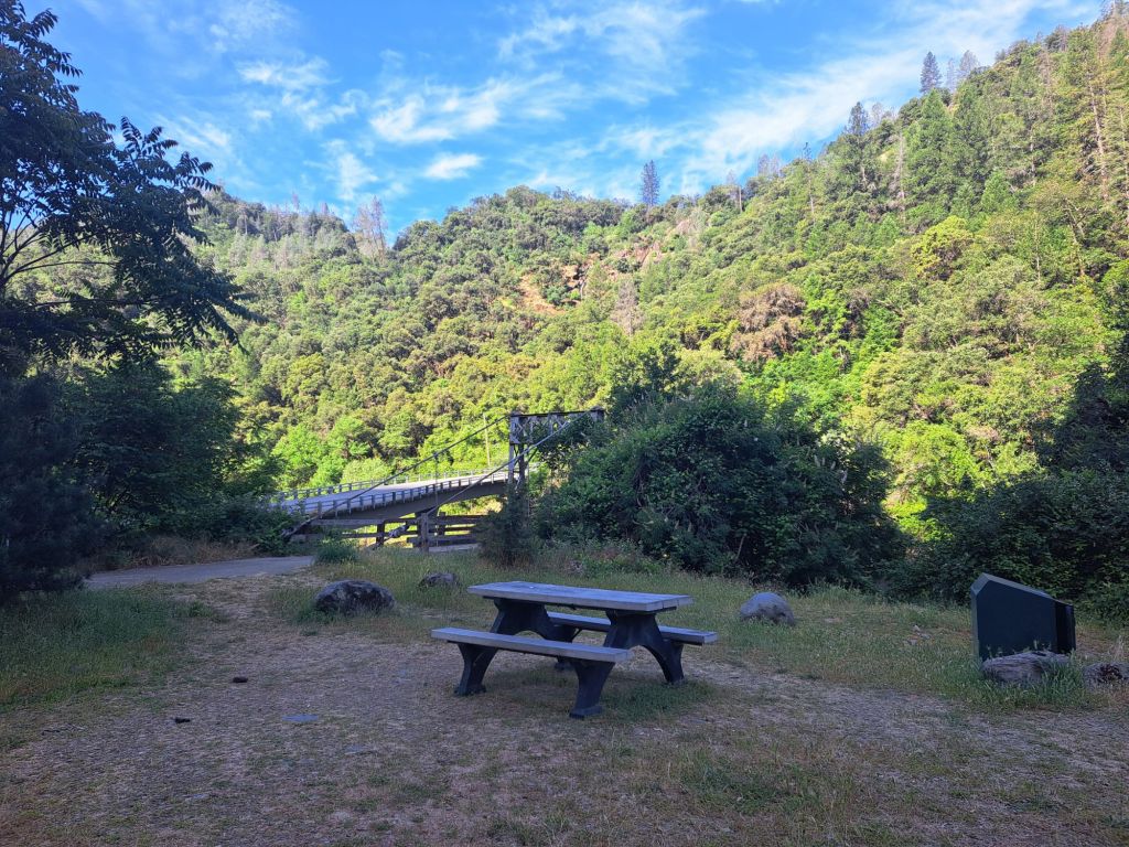
Truss bridge
Irked, I called the Auburn Recreation District Office. I said that I wanted to camp there, and the campground was empty, but I wasn’t able to reserve a spot.
They told me that I could camp there. They told me to call Reserve California, promising they would help me out.
They didn’t help me out.
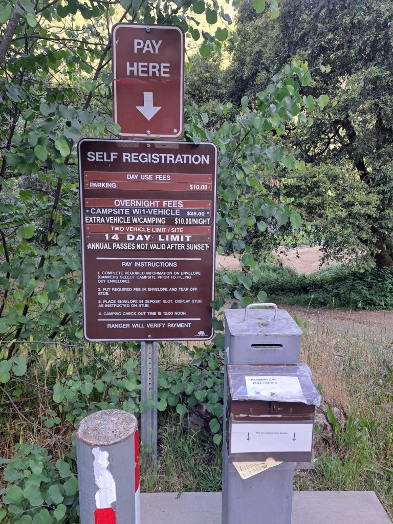
Meanwhile, a ranger had pulled up. I overheard him tell another camper that they could self register using the iron ranger.
Self registration station
I hung up the phone, and did the same thing. I put money in the envelope for three nights. The next day, a sign with my name on it showed up on my campsite.
So far, so good. I was on site 11, and I liked it a lot. The sites in the back row are kind of close together, but well shaded.
When the weekend rolled around, I wanted to pay for three more nights. But, this time, the ranger told me I could only pay for one at a time.
Toxic algae warning sign
I asked if I could leave the money in the envelope for him, because I wanted to leave early to go hiking. He told me that, no, I had to come back at noon.
I explained that I have a disabled pass because of an anxiety disorder. There are a thousand reasons why I need to be able to leave early, and be gone all day.
I specifically asked if I could pay early as an accommodation for my disability. Again he said no.
Every time a man came up to pay, the ranger made me wait while he helped the man first. After he did this several times, I got irritated.
Truss bridge
I told him I was going to call Auburn SRA to complain, because I heard him tell another camper that they could just leave the money in the envelope for him.
When I picked up my phone to call, he said, “Wait a minute, I just told you I was going to help you right now.” This was actually the opposite of what he had just told me.
Hike to waterfall across the road
I said, “No, you told me you’re going to help all these men waiting in line first.”
He then said, loud enough for everyone to hear, “I have to help you first, because you’re special.“
He emphasized the word “special” as if to imply that I’m mentally retarded.
The actual reason I wanted to be helped first is because I was there first. I was first in line. I’d been waiting for him since 8am.
Looking over the North Fork American River from the truss bridge
I paid him for that night. I stayed on a sunny site on the upper loop, which I hated. The upper loop was way too crowded.
I had made online reservations to be back at site 11 for the following week, but I canceled them. After that interaction with that ranger, I just wanted to leave.
Crossing under 49 to waterfall
It was also hard to camp there because there was no cell service, no outlets to charge electronics, the toilets were nasty, and the closest town was thirty minutes away.
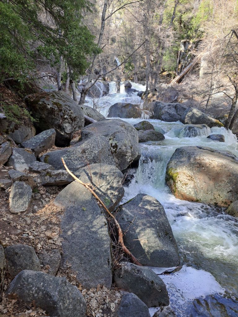
My favorite thing about Mineral Bar is the location. Stevens Trail in Colfax, which is one of my favorite trails, is just a few miles away.
There was also a small waterfall right across the bridge from the campground. From the road, I had thought it was the waterfall from Stevens Trail.
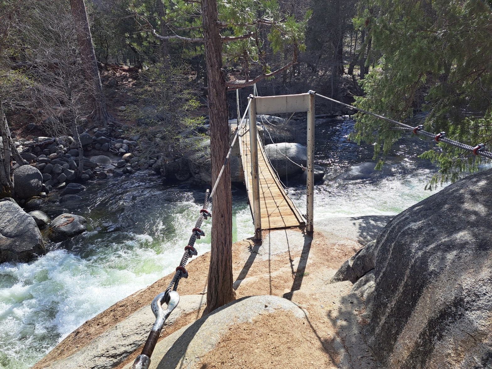
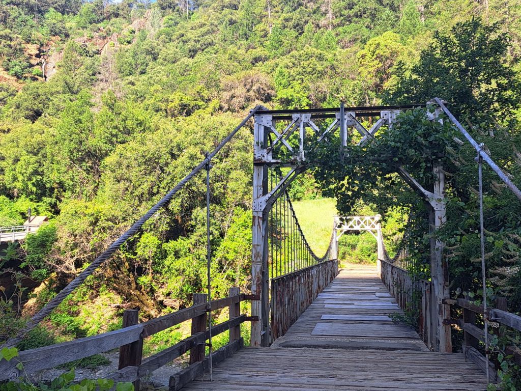
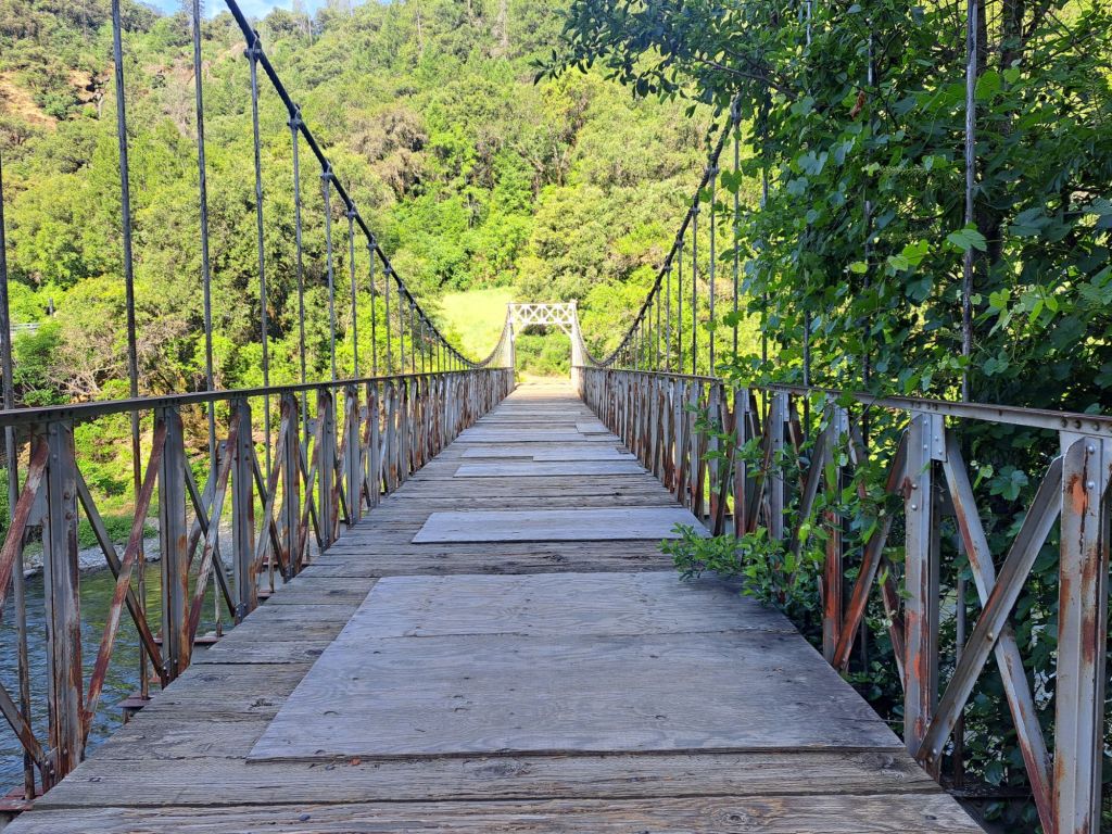
Lots of boards on the truss bridge
The old wooden truss bridge across the North Fork American River was very sketchy. It had dozens of plywood board patches.
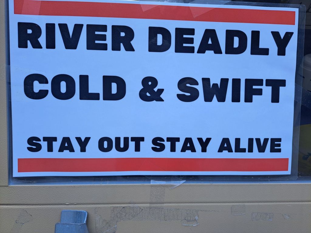
Combined with all of the “river cold deadly and swift, stay out stay alive” signs, it was a little scary. But, after watching some teens march confidently across it, I did the same.
River deadly cold and swift sign
Overall, I love Colfax, but I hated Mineral Bar Campground. It’s hard to imagine myself staying there ever again.
After my first couple of nights camping at Pantoll, I wanted to move somewhere quieter.
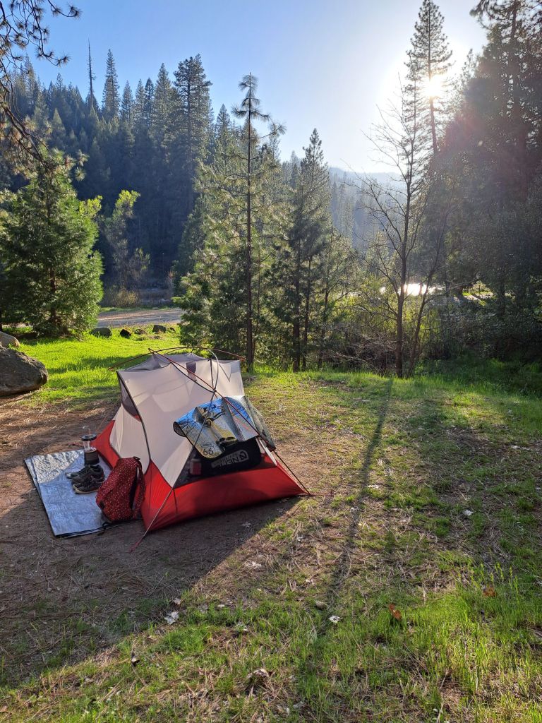
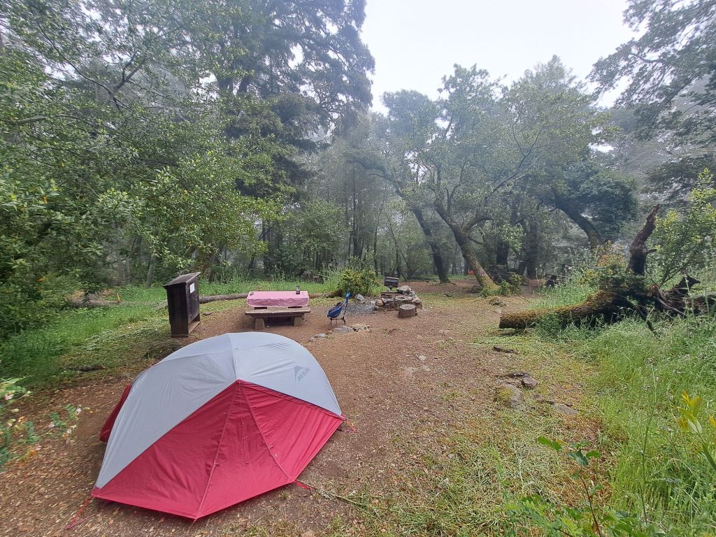
One of my sites at Bootjack. Note how the tent area is raised above the rest of the site
I was surprised to find that Bootjack campground was just a short walk away– literally just 0.4 miles away up the Matt Davis trail.
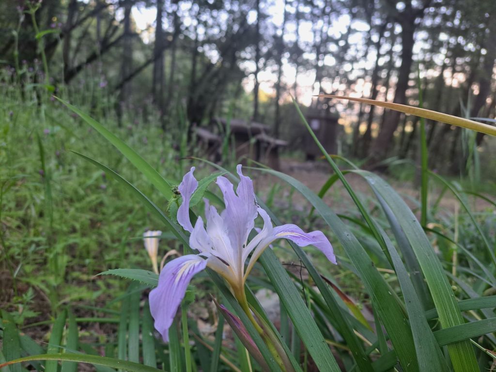
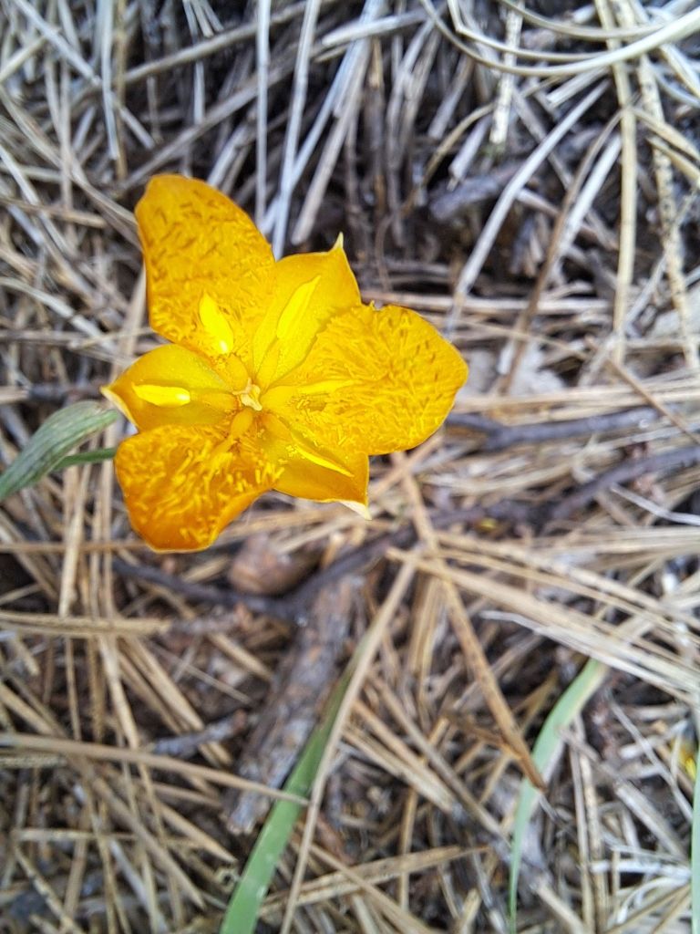
Wild iris
I found an open site, set up my tent, ran back down to the Pantoll Ranger Station, and paid for my first couple of nights at Bootjack Campground.
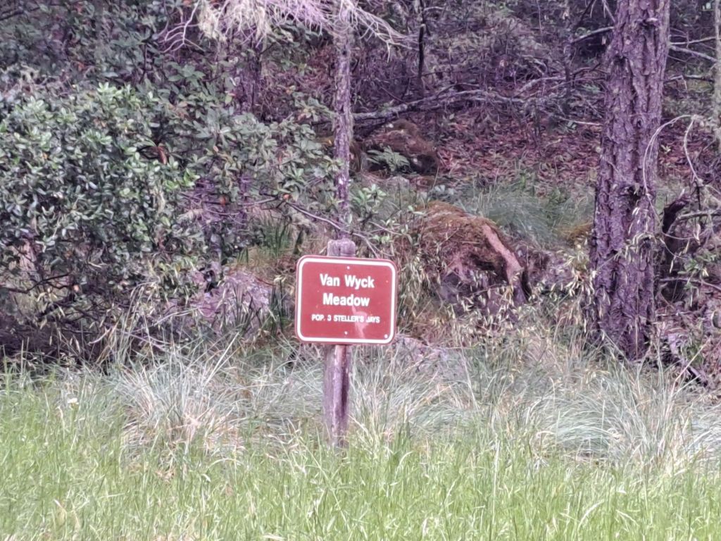
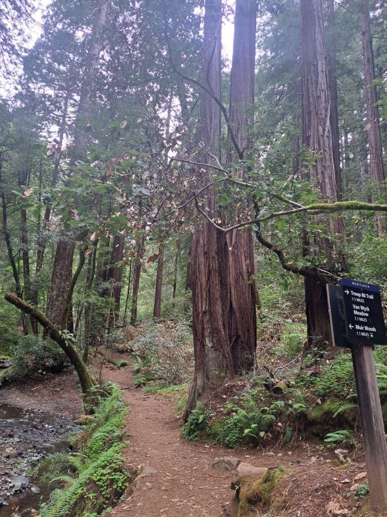
Van Wyck Meadow sign: Population: 3 Stellars Jays
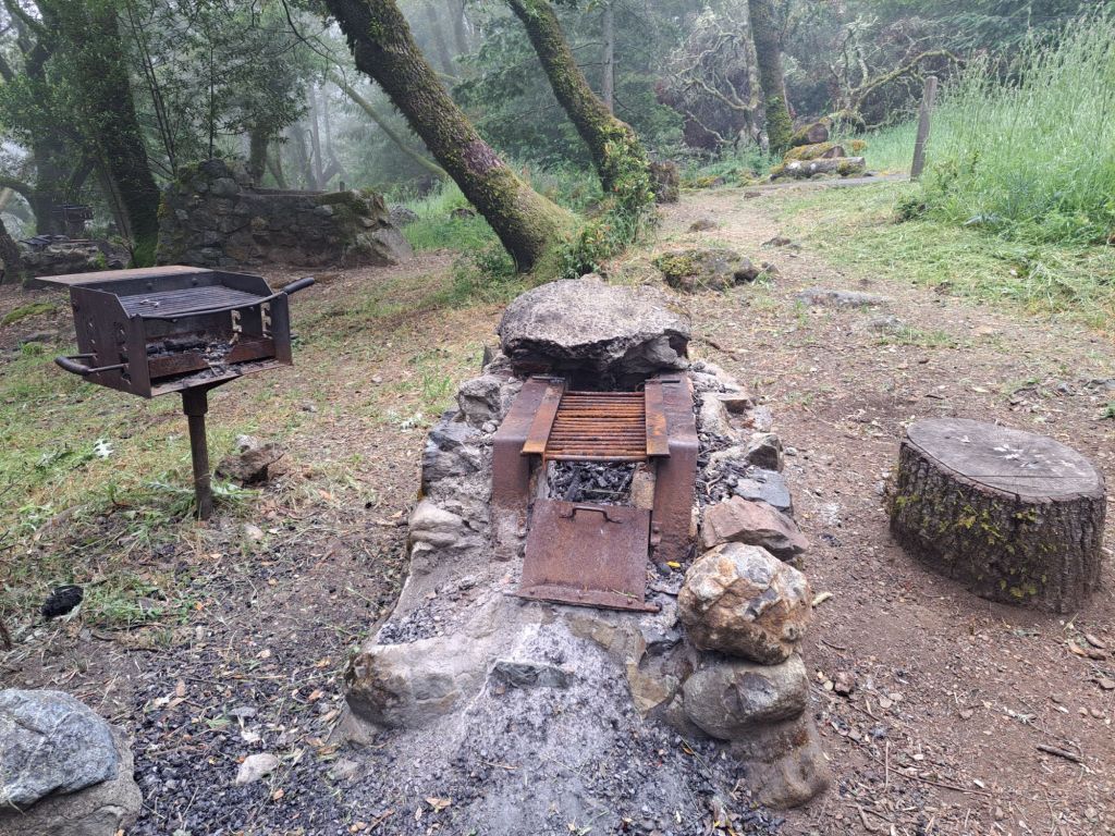
I picked out site 7 because, on top of having its own stone grill and barbecue, it was also closest to the water and washing stations.
Stone fire pit and barbecue
Site 7 is near the top of the hill, but, at the time, there were still three sites above it. (Site 9 has since been buried in fallen trees for unknown reasons.)
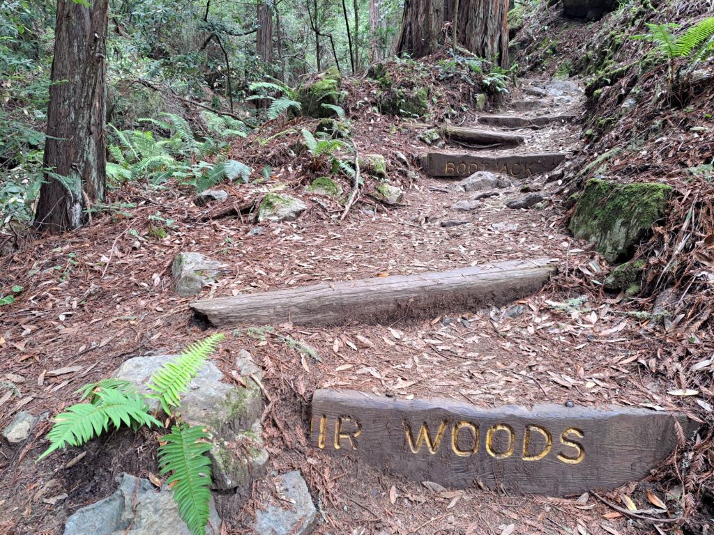
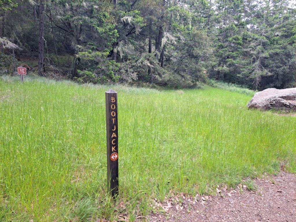
Bootjack trail sign
Most of the sites (including mine) were split level, with a flat area for a tent clearly set above the area with the picnic table, racoon cabinet, and grills.
One of the sites at Bootjack
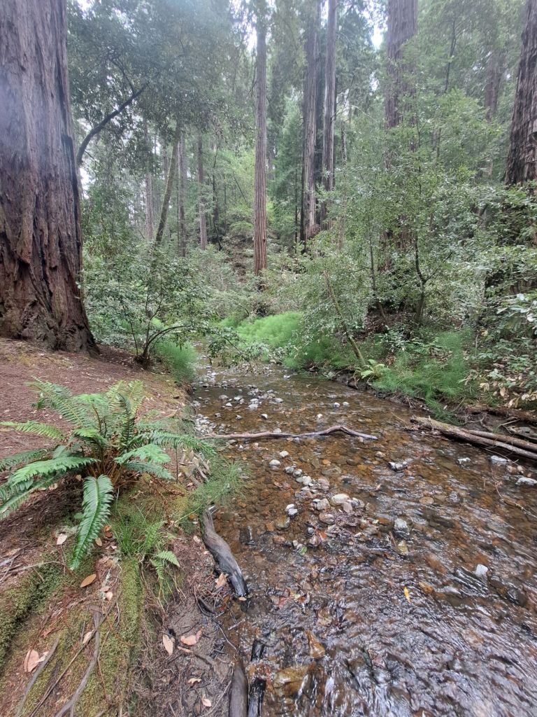
Since I set my tent up right next to the creek, and there were only two other campers in the whole campground, I assumed I would finally get a peaceful, quiet night’s sleep.
Wildflowers in Fern Canyon
What I got instead was a lesson about leaving food in my tent. A relentless raccoon kept me awake from about 2am to 6am.
I kept scaring it off by making loud noises, but it kept coming back.
A pink poppy
The camp provides racoon boxes, but I had accidentally left some beef jerky and dried fruit in my tent. Never again.
Closeup of lichen on Sequoia
Other than that, though, this campground was really peaceful. I’ve ended up coming back at least two more times.
Pipevine
By Memorial Day weekend, the campground was entirely full, and it was becoming difficult to get a spot.
I boiled water outdoors for the first time at Bootjack
I had secured my spot by arriving very early on Wednesday morning, and paying through the next Tuesday.
My first outdoor meal cooked with boiled water
I remember watching the last couple snag the last spot. “Babe, it’s open! Bring the tent! Bring everything you can!” They were so happy, they looked like they had just won a prize.
Redwood Creek on the way to Muir Woods
Of course, Memorial Day weekend was not a quiet, peaceful weekend. I’m sure it was much worse at other campgrounds, but at least a few people came here to party late into the night.
Trail down to Muir Woods
Pantoll Rangers cruise through frequently to make sure there are no vandals in the parking lots, but they are not as concerned about midnight campground music.
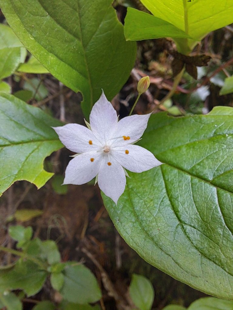
A wildflower by the creek
The cost to stay here is surprisingly cheap, at only $25 a night, which you can get half off of with a disabled or senior access pass.
Trail down to Muir Woods
The cheap price must be because the bathrooms aren’t well kept, and because you can’t drive to your site. But, if those things aren’t very important to you, then, this campground is a steal.
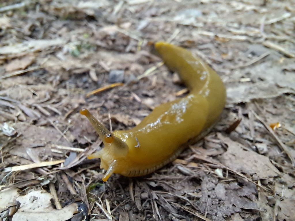
Banana slug
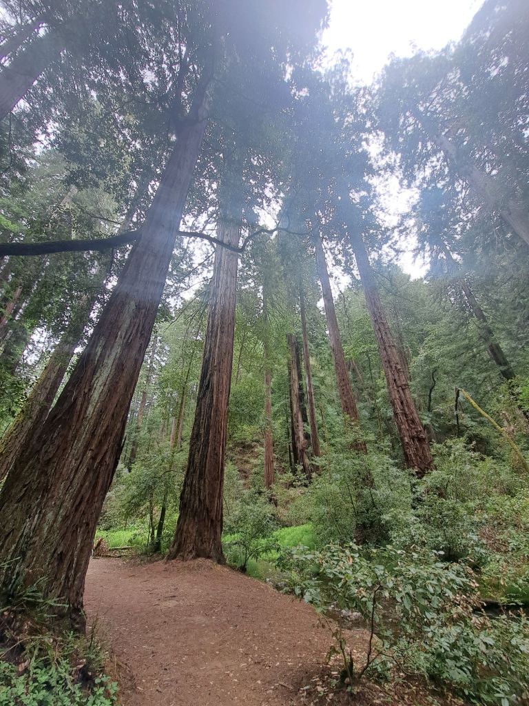
Bootjack is located in prime hiking territory, literally in the middle of the Matt Davis and Bootjack trails. It’s only two miles down to Muir Woods.
On the trail down to Muir Woods
In recent years, Muir Woods has become so popular that they’ve begun requiring reservations to enter through the front gates. Tickets sell out months in advance.
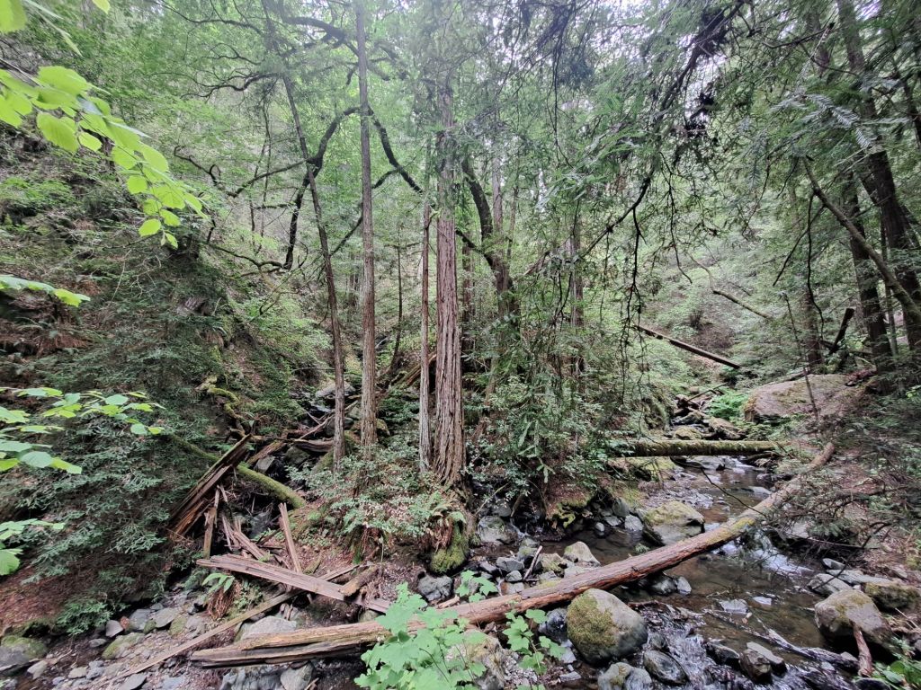
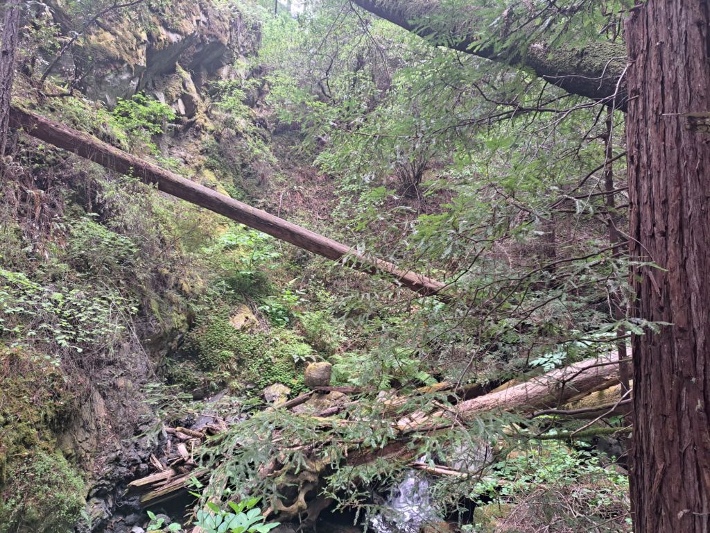
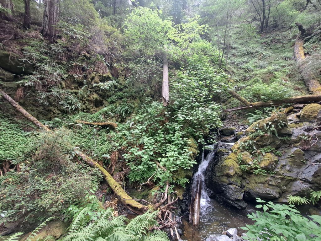
Fern Canyon, Mount Tamalpais
There are no gates on the hiking trails, though (except for on the Redwood Creek Trail by the front entrance). It is free to hike in via the Matt Davis, Bootjack, Stapleveldt, or Hillside trails.
Fern Creek
So, for only $25 a night, you can camp in Mount Tamalpais, hike to Muir Woods, and park at any other state park (like Stinson Beach or Cataract Falls).
Fern Canyon
If you are there for more than a few days, the hikes to Mountain Theater and West Point Inn are also both incredible (but challenging).
Trail to Muir Woods
Of course, my personal favorite hike in the world is Dipsea, which intersects with the campground trails just half a mile away at Cardiac (which is wheelchair accessible via the Old Mine Trail).
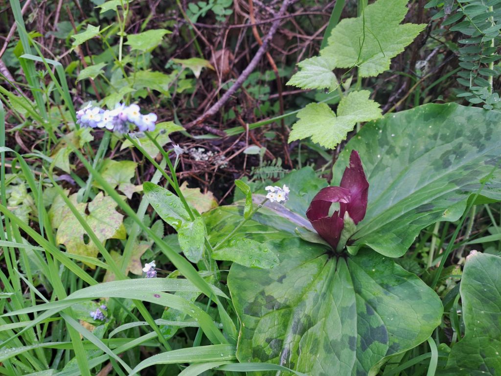
Wild iris infested with ticks
This is one of my favorite campgrounds I’ve found so far. As I continue to travel around Northern California, I’m hoping to find more high quality, first come first serve campgrounds like this.
Malakoff Diggins was once the site of the world’s largest hydraulic gold mine. The corresponding town of North Bloomfield had a population of over 2000 people.
Hydraulic gold mining at Malakoff Diggins. Source: United States Geological Survey media
In hydraulic gold mining, giant water jets were used to wash away entire mountainsides so that the gold could be extracted from them.
Because Californian gold forms in flakes rather than in chunks, mercury was used to separate the flakes from the rest of the sediment, which was then dumped into giant piles of rocks.
Valleys were filled with rocks and sediment, which began to flow downstream into the Yuba and American rivers.
The Diggins, former site of the world’s largest hydraulic gold mining operation
So many tons of rocks were washed into the rivers that it filled up the bottoms of the riverbeds, causing the rivers to become more shallow, narrow, and swift.
Deadly floods began to hit the towns of Marysville and Sacramento. After enough people died and enough businesses were destroyed, hydraulic gold mining was finally outlawed.
The first environmental protection law in California banned hydraulic gold mining in 1884. The thriving town of North Bloomfield began to die off, and was eventually entirely abandoned.
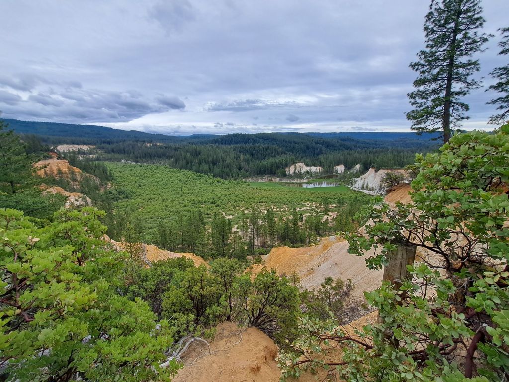
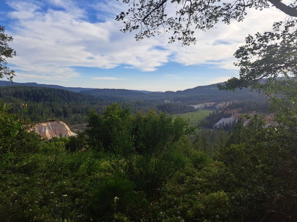
The Diggins from Rim Trail
A hundred years later, California turned the remains into a state park. Malakoff Diggins contains the ghost town of North Bloomfield and the ‘Diggins,’ which is the site of the old gold mine.
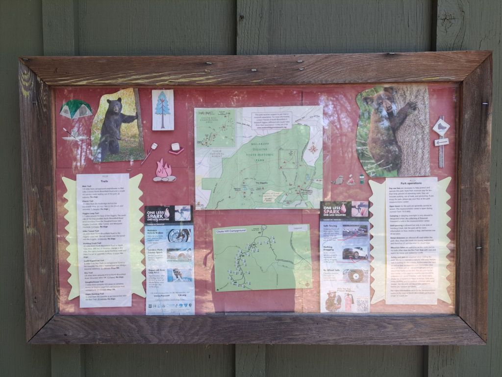
Chute Hill Campground is the only official campground in Malakoff Diggins State Park.
Map of park
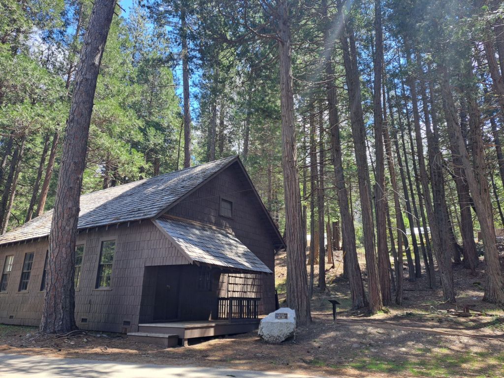
Aside from the campsites, there are also three cabins, which can each sleep four to eight people.
Technically, the park is located on the outskirts of Nevada City, but Nevada City is actually about half an hour away.
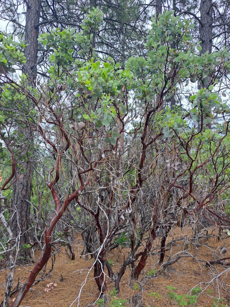
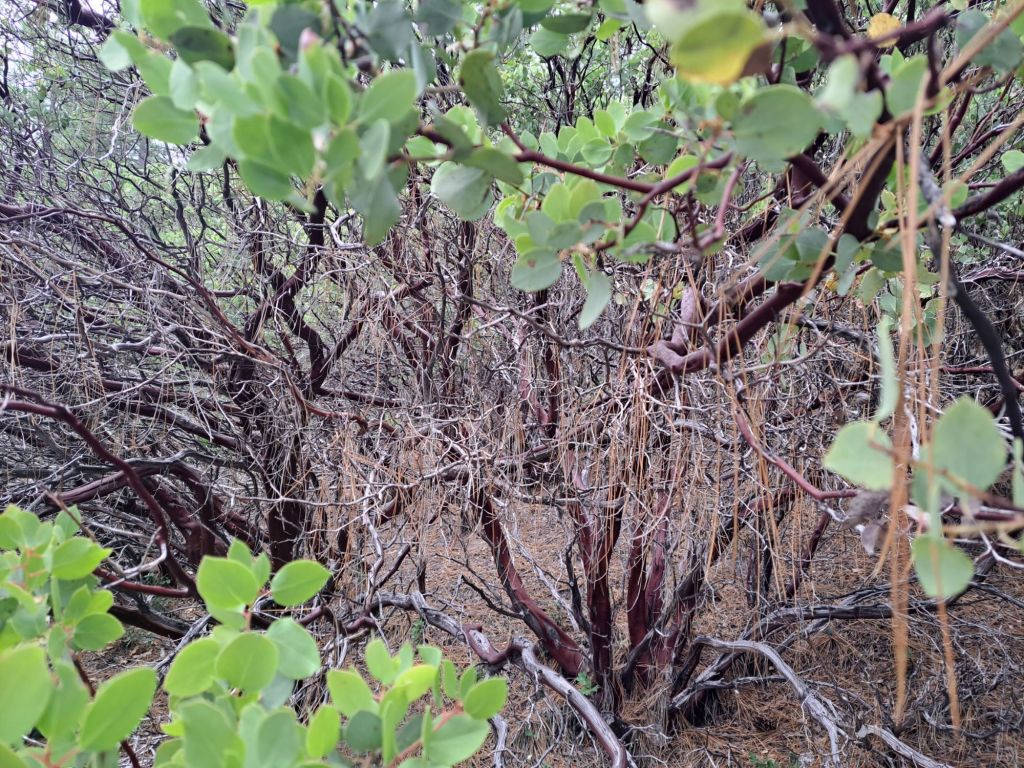
Manzanitas on Rim Trail
Before visiting Malakoff Diggins State Park, there are a few important things to know.
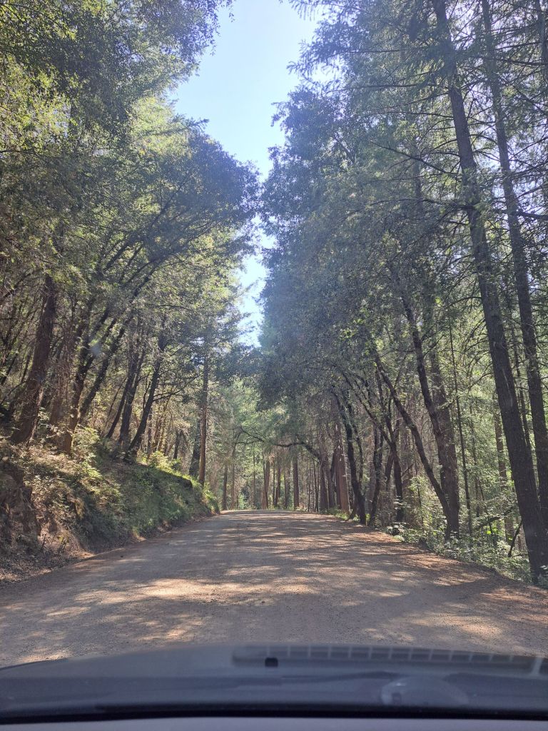
First of all, following the Google Maps directions will send you down an 8 mile long dirt road for no reason.
Driving in on a nicer section of the dirt road
It’s much easier to take highway 49 to Tyler Foote Road. It’s a quarter mile longer, but it’s paved all the way.
My first time driving in, I took (the dirt) North Bloomfield road, and it was awful! The road is mainly used for off road vehicles, and it’s full of giant gaps and potholes.
Once I finally made it in to the park, I didn’t see a kiosk, so I went ahead and set up. As I later found out, the check in kiosk is actually located inside the museum/visitor center.
Check in sign at campground
When I read on the website that there was an old town in the park, I was picturing a lively town with retail shops and restaurants.
There are absolutely no shops, stores, or restaurants inside of the park. The ‘old town’ is literally just the skeleton of empty buildings where the town of North Bloomfield used to be.
The museum sells ice and firewood, but nothing else.
The park contains several hiking trails, but they’re all relatively short. An avid hiker could easily cover most or all of them in a single day.
Map of campground
Since the trailhead for the Slaughterhouse Trail was only one campsite away from mine, I decided to start there.
It only took about ten minutes to take this trail past the cemetery and church to the museum. The grade was steep in some places, but the trail was easy to follow.
Next, I took the Rim Trail around the rim of the ‘Diggins,’ which is the name bestowed upon the hydraulic gold mine graveyard.
List and descriptions of park trails
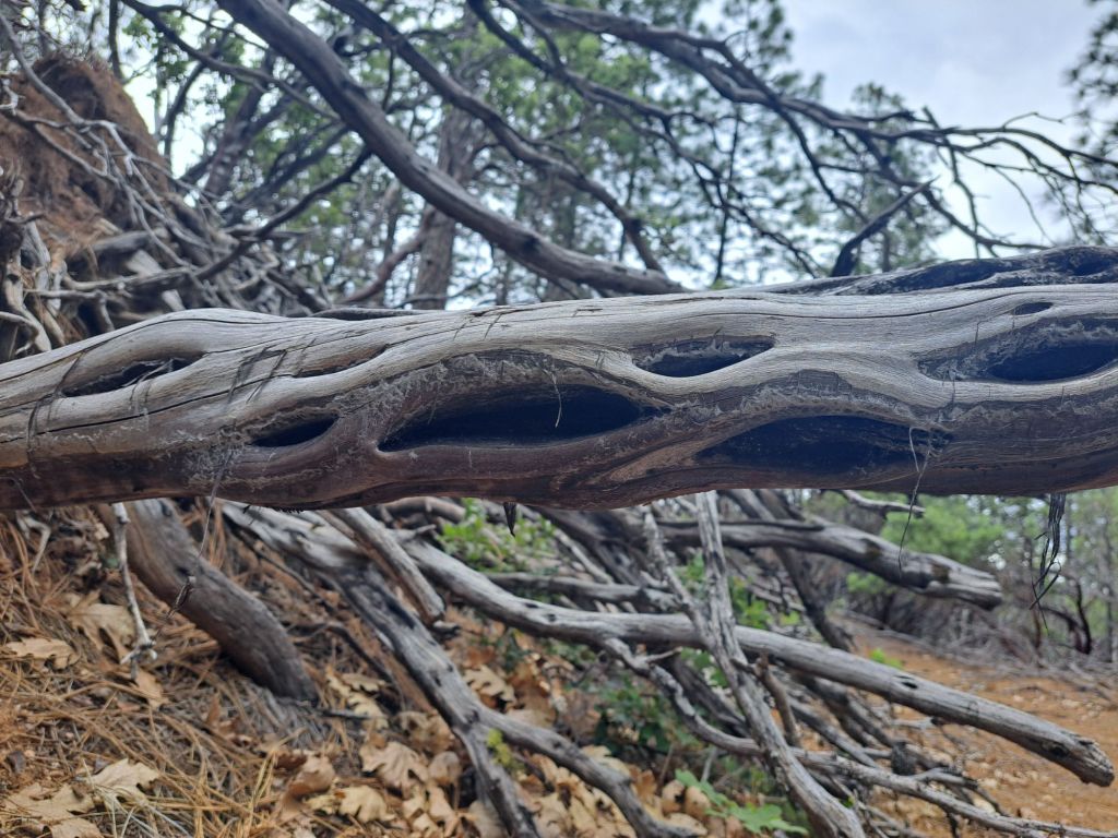
Some of the manzanitas on the rim trail appeared to be ancient. Their bark varied from crimson red to ash gray. Some of them had really interesting holes in the branches.
Manzanita branch
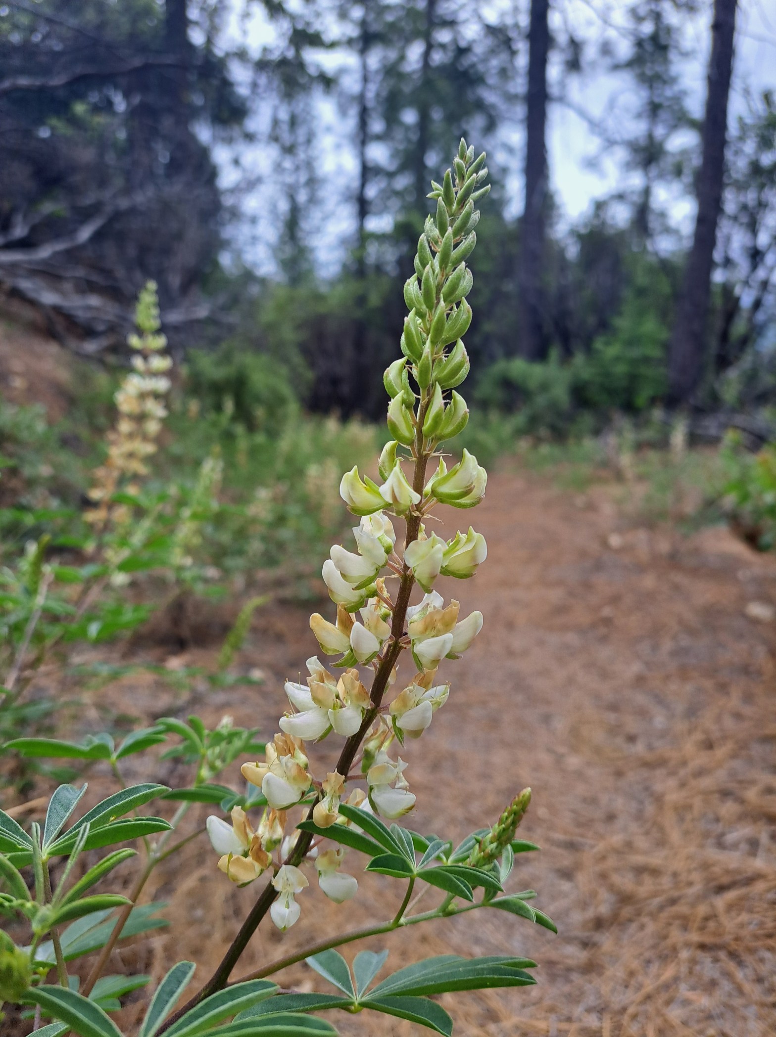
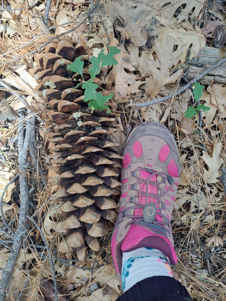
I also found a few patches of white lupine, and, of course, lots of redwoods. There were a few sugar pine trees, which I noticed because of their giant pinecones, which are about as long as my forearms.
White lupine on the side of the Rim trail
Some of the manzanitas looked kind of hairy to me. It took a while to figure out that this was because they were covered in pine needles fallen from the trees above.
Manzanitas covered in pine needles
The view of the diggins was not any better than it was from the outlook inside of the campground, which was right next to my campsite.
The Diggins Overlook by my campsite
Unfortunately, the Rim trail was infested with mosquitos, which made me get tired of it very quickly.
Sugar pine cone bigger than my hiking boot
I hiked back to the visitor center, and heard the volunteer ranger recommending the Diggins hike to someone else. She said, “I wouldn’t miss it.”
Very old manzanita branches on Rim trail around the Diggins
So, the next day, I took the Diggins Loop Trail down into the actual Diggins. Along the way, I got lost, and ended up in an NPS graveyard of artifacts.
Manzanitas growing in front of redwoods
I didn’t take any pictures, but it was wild. There were literally just piles of antique cars, stoves, and mining equipment.
Manzanitas on Rim Trail
Walking around the Diggins was kind of interesting. It felt just like walking around on the gold tails in Folsom (where I lived for the last fifteen years), except on a larger scale.
Manzanita blossom on Rim Trail
The most interesting thing to me was that the redwoods were literally buried fifty feet deep in rocks and sediment, but were still mostly thriving.
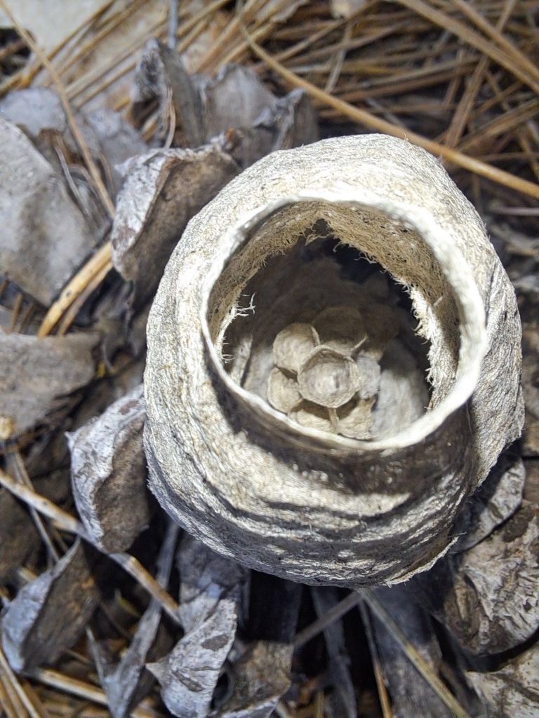
Tiny nest found on Rim trail
I could tell that I was hiking through the midsection of the trees, which felt really weird to me, since I’m so used to hiking underneath them.
Manzanitas on Rim trail
In between the rock dunes, a few pools of water had turned interesting colors of turquoise due to the mineral pollution that washes down during rainstorms.
Horsetail blossom on Rim trail
According to educational signs in the park, this runoff is responsible for roughly two tablespoons of mercury washing out into the Pacific Ocean per year.
Diggins overlook
Since I was alone and without cell service, I decided not to take the tunnel trail through the old gold mining tunnels, even though this sounded like the most fun hike to me.
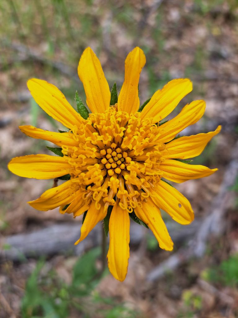
Sunflower on Rim trail
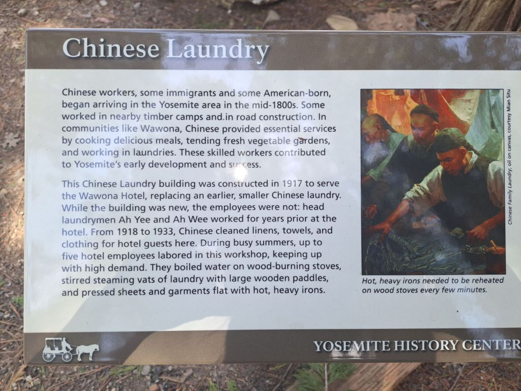
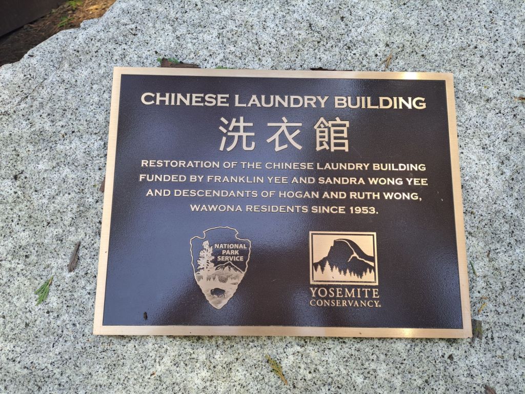
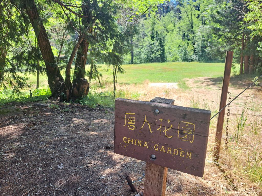
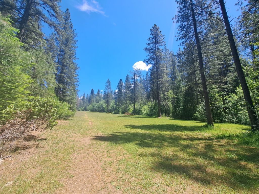
Back in North Bloomfield, I found a large lawn called China Garden, but it’s unclear what the historic significance of the lawn was.
Entrance to China Garden in North Bloomfield
Presumably, Chinese immigrants must have played a part in gold mining at Malakoff Diggins. Like some other state parks, they probably need to add this information to their signage.
China Garden, North Bloomfield
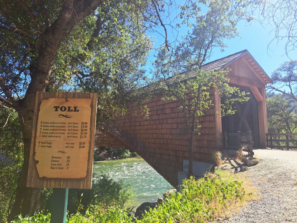
The next day, I drove out to the Bridgeport covered bridge, which advertises itself as being the longest covered bridge in the world.
World’s longest covered bridge
I was not super impressed, although the view of the river from the bridge was pretty. Lots of people were swimming or rafting the waters below.
Looking out onto the Yuba River from inside the bridge
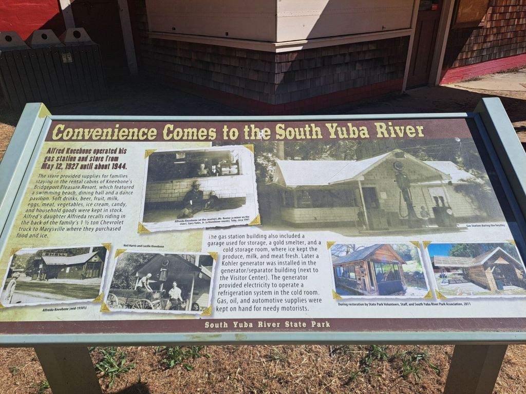
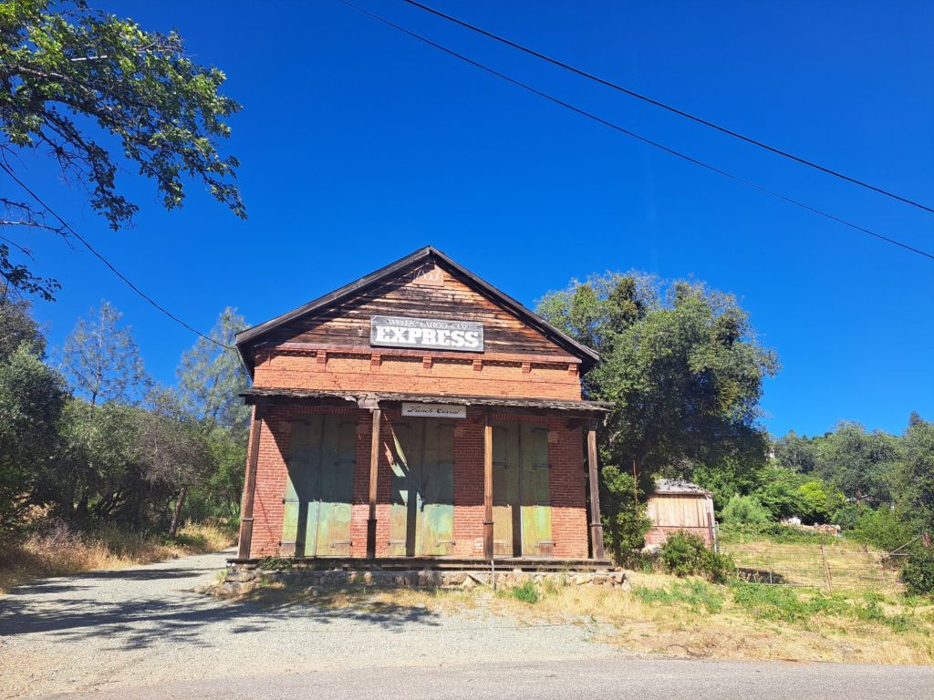
On my way out, I noticed an old closed down Shell Station, and a historic Wells Fargo building.
Old Shell gas stationEducational sign explaining the history of the Shell stationOld Wells Fargo building on the side of the freeway
While I did not take any pictures of the campsite itself, it was very pretty. As compared to other state park campsites, it was on the larger side.
Black lichen on Rim trail
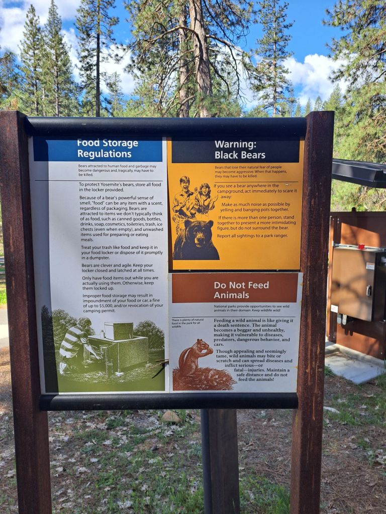
The rangers make you sign an acknowledgement of the bear policy when you check in (there are bears here, and food must be stored properly), but I personally had way more issues with mosquitos!
A tiny insect nest
The fees were not bad, especially with my access pass. If I stayed here again, I would probably want to stay in one of the cabins during the off season.
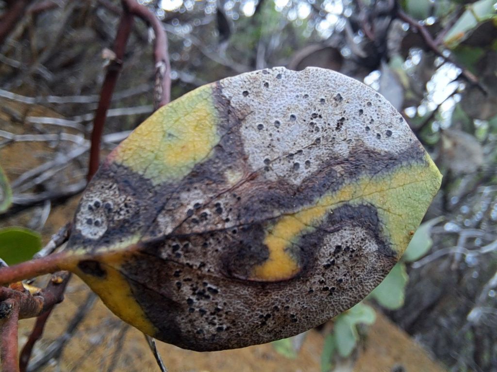
A sick manzanita leaf
This wasn’t the most beautiful place I’ve ever camped, but it was nice and peaceful, and the history was interesting to learn about.
The first time that I left the homeless shelter to go camping, I didn’t know that I would be leaving forever the next week.
I thought that I just needed a break from all the commotion.
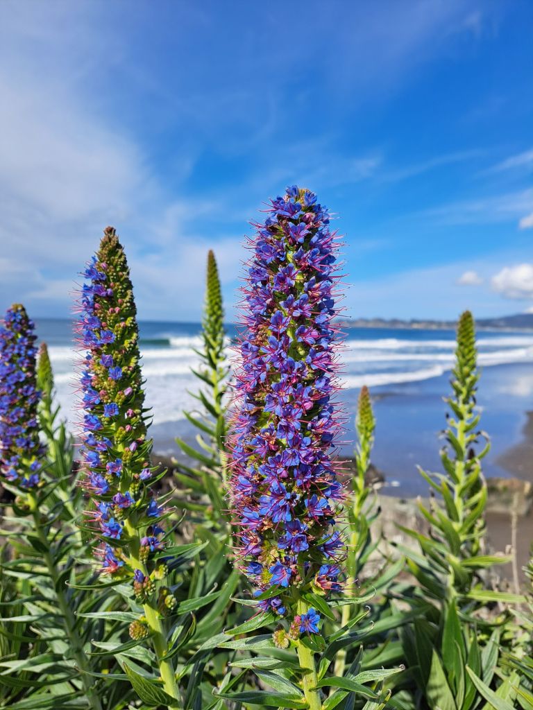
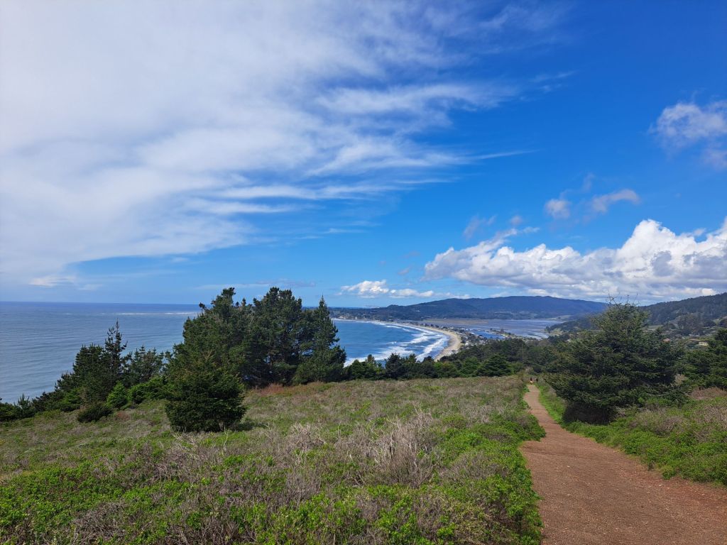
Flowers on Stinson Beach, which I hiked to from Pantoll Campground
For some reason, we had been given a “pass” that weekend, which meant that, if we chose to spend a few nights elsewhere, it wouldn’t count towards our total.
The shelter does this from time to time to allow everyone a chance to spend extra nights with friends and family.
I’d never been camping alone before, but I was pretty sure I could pull it off.
I’d been camping a few times with other people, and I had just recently purchased the backpacking tent that I’d had on my Amazon wishlist for years.
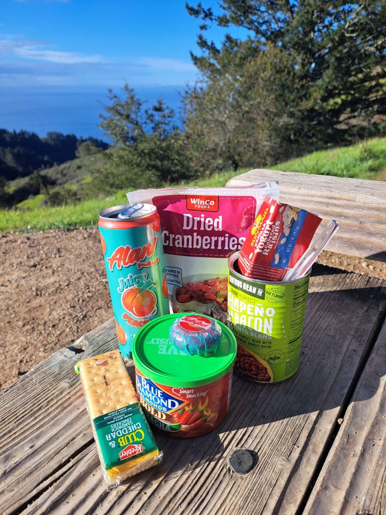
It had been sitting in storage. I went to get it out, stocked up at my favorite dispensary, and went grocery shopping.
My grocery cart for my first solo camping trip
I left early in the morning, and got to Pantoll around 8am. I was relieved to see that it was mostly empty.
Pantoll is a hike in, first come first served campground. Pantoll and Bootjack are officially the only two campgrounds in Mount Tamalpais where one can camp without a reservation.
I noticed the self registration envelopes, but had never used one before. I was reading the sign, trying to figure out how they worked, when a ranger surprised me by opening up the window.
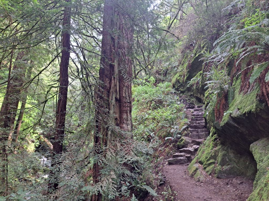
Steep Ravine Trail, Mount Tamalpais
“Good morning!”
“Good morning! Can I pay you here to camp at Pantoll?”
I can’t remember which site I was on, but I know it was the second or third closest to the top of the hill.
I had figured that the higher up the mountain I went, the more peace and quiet I would get.
As I laid out the footprint for my tent, it started to rain. My neighbor asked me if I needed a hand, but I was determined to learn how to do it alone.
She looked at me like she thought I was crazy, but then shrugged.
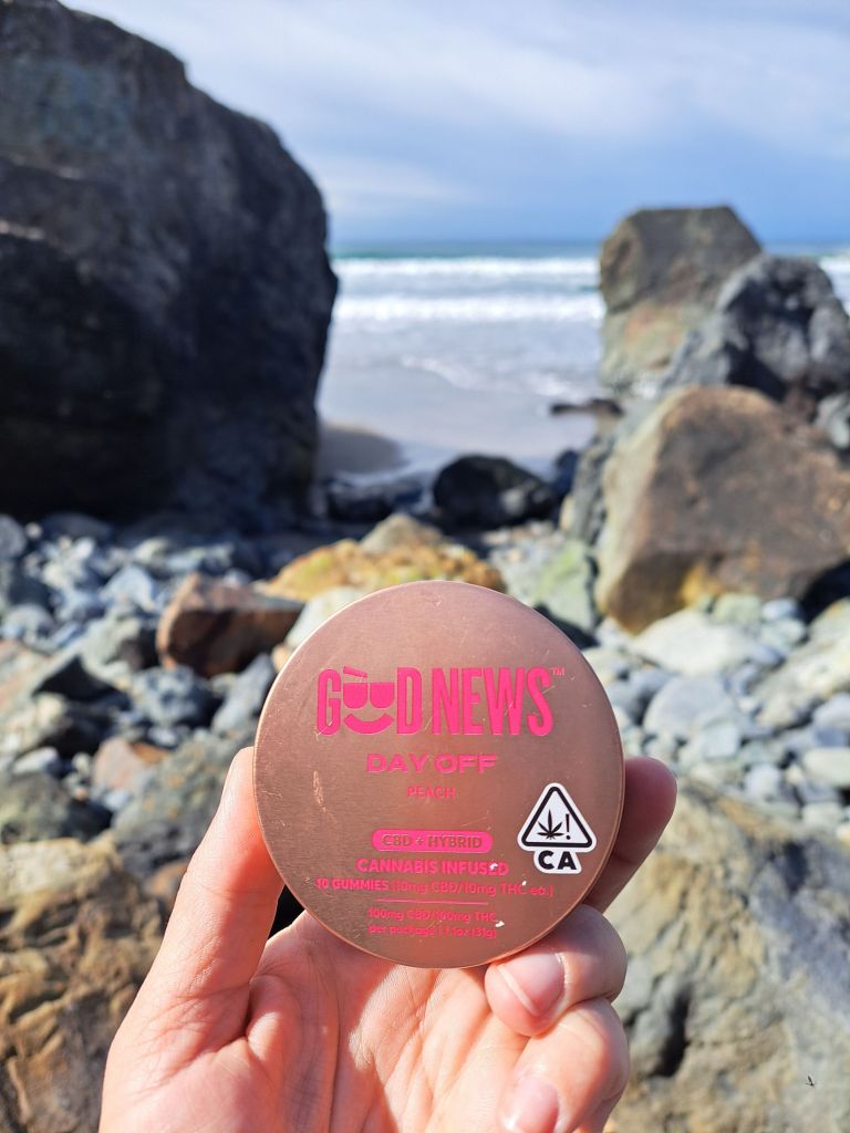
A day on the beach is even better with a gummy
I laid out my tent. Tents are rain proof, right?
I pulled out the poles, and found them to be latched together with some kind of lock that I couldn’t remove. I tried super hard to remove them, before figuring out that they were meant to be there.
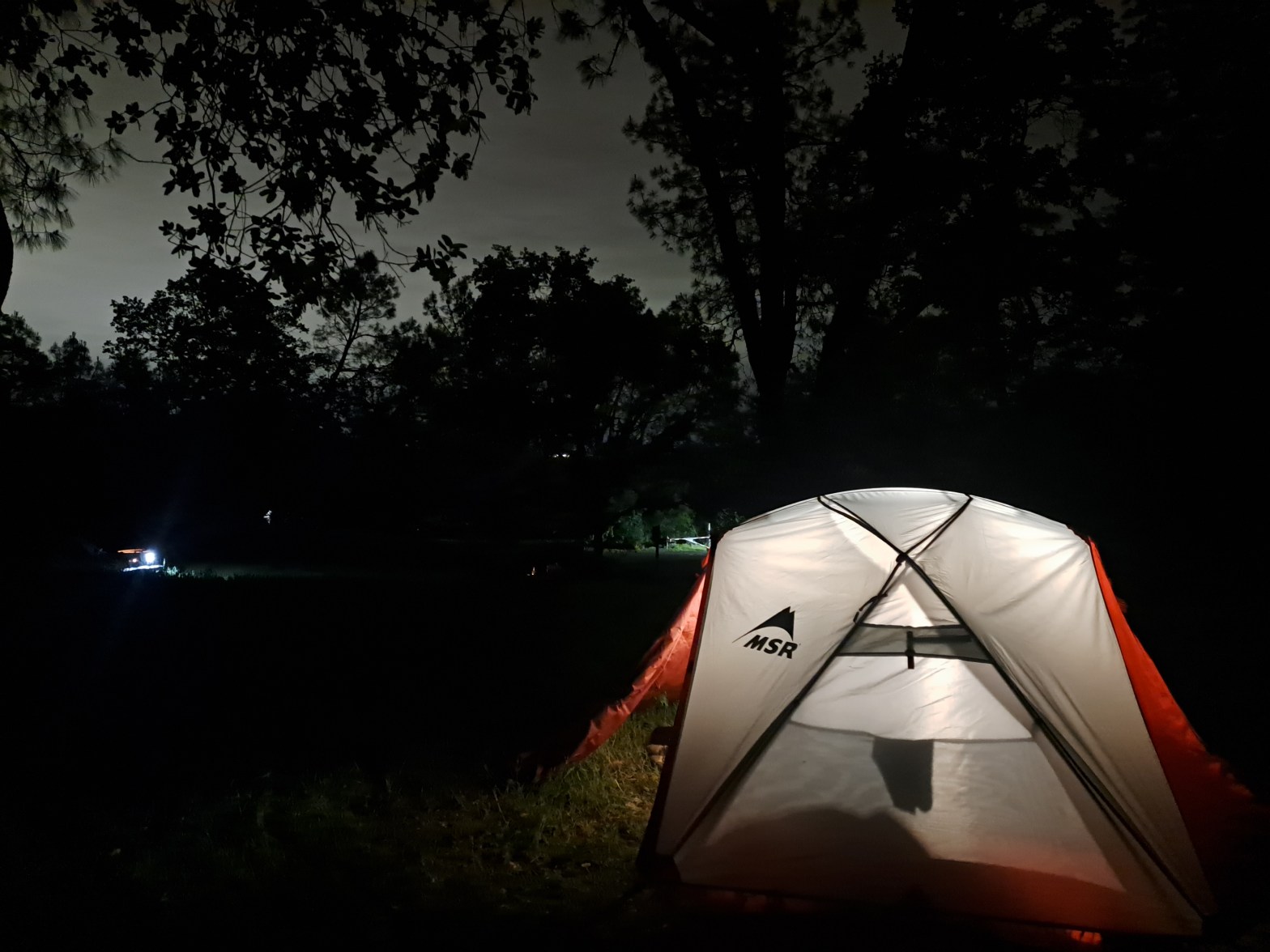
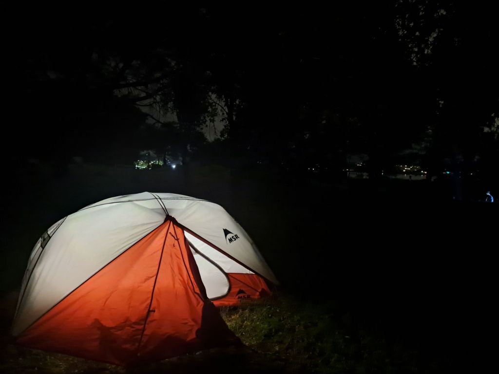
At some point, I ran down to the parking lot, connected to the wifi from the Pantoll Ranger Station, and Googled “How to set up an MSR Elixir 2.”
I then ran back uphill, and put up the tent. I couldn’t understand why it was all wet inside. I think I learned my lesson about setting up in the rain.
For the first night, due to the rain, it was extremely quiet in the campground. For the first time in months, I slept through the night.
Some flowers on Mount Tamalpais
The next night, the girl next to me left, and was replaced by an arguing young couple. They argued all night long, and I had forgotten to bring my ear plugs.
The next morning, I moved over to Bootjack, which is just down the road.
At $25 a night, Pantoll is relatively cheap, especially considering that some of the campsites overlook the San Francisco Bay.
Those with California State Parks disability passes get half off of all camping fees.
Parking and day use fees are included in camping fees, in general.
I hadn’t realized it when I first arrived, but the top four campsites have amazing views of the city lights at night.
Breakfast and snacks at Pantoll with bay in background
Of course, the reason Pantoll is so cheap is because it’s a hike in campground, which means that you cannot park at your campsite, like you can at most campsites in Yosemite.
You leave your car in the parking lot, and then carry all your stuff up the hill. The two campsites closest to the bottom of the hill are reserved for ADA campers unless the campground fills.
Pantoll is truly first come first serve in that, if you show up to reserve a campsite, and someone else has tried to pay for that spot online, the rangers will cancel their reservation.
Priority goes to whoever has a tent physically set up on the site first.
The campground itself is rustic and beautiful. It has a similar look and feel to all of the nearby camping trails. Lots of redwoods, and lots of moss.
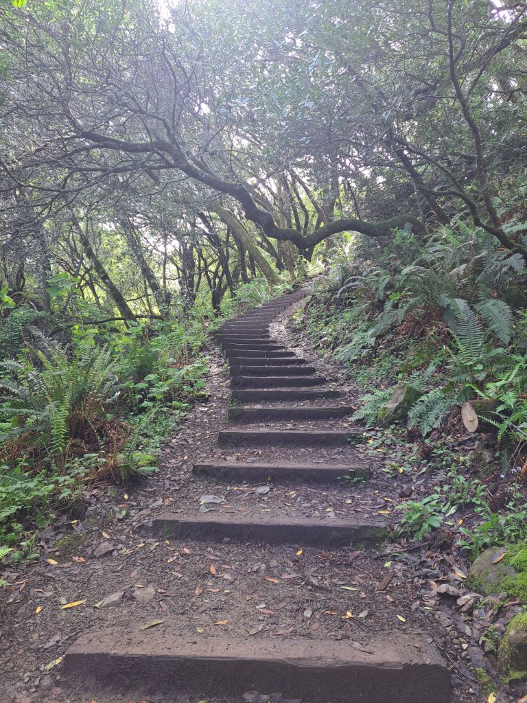
One of the trails to Muir Woods
Unfortunately, I did not take very many photos of the campground itself.
The bathrooms have mirrors and flush toilets, but they get nasty by 10am, especially on a busy day. There are no showers.
One of the main advantages to camping at either Pantoll or Bootjack is the ability to hike into Muir Woods without a reservation.
Normally, reservations for Muir Woods sell out months in advance. The entrance fee is around $15/person.
However, there are no entrance fees or reservations required to hike in via the Ben Johnson or Stapleveldt trails, which are both easily accessible from Pantoll.
Dipsea Trail, which runs between Muir Woods and Stinson Beach
Depending which way you go, it’s about a two to three mile hike downhill into Muir Woods.
Other great trails nearby include, well, every trail in Mount Tamalpais and Tennessee Valley.
The hike out to Cardiac Point on Dipsea is just a half mile stroll down an accessible gravel path from Pantoll.
Cardiac Point is so named because it is five miles uphill from the bottom of Dipsea Trail.
It overlooks the San Francisco Bay and the Golden Gate Bridge, which is only about twelve miles away.
Approaching Stinson Beach on Dipsea Trail
Driving into the city from Mount Tamalpais is a no brainer. But, of course, you have to pay the $9.50 bridge fee, so if you’re going into the city, it’s best to plan a whole day there.
I loved camping at Pantoll, and would love to camp there again.
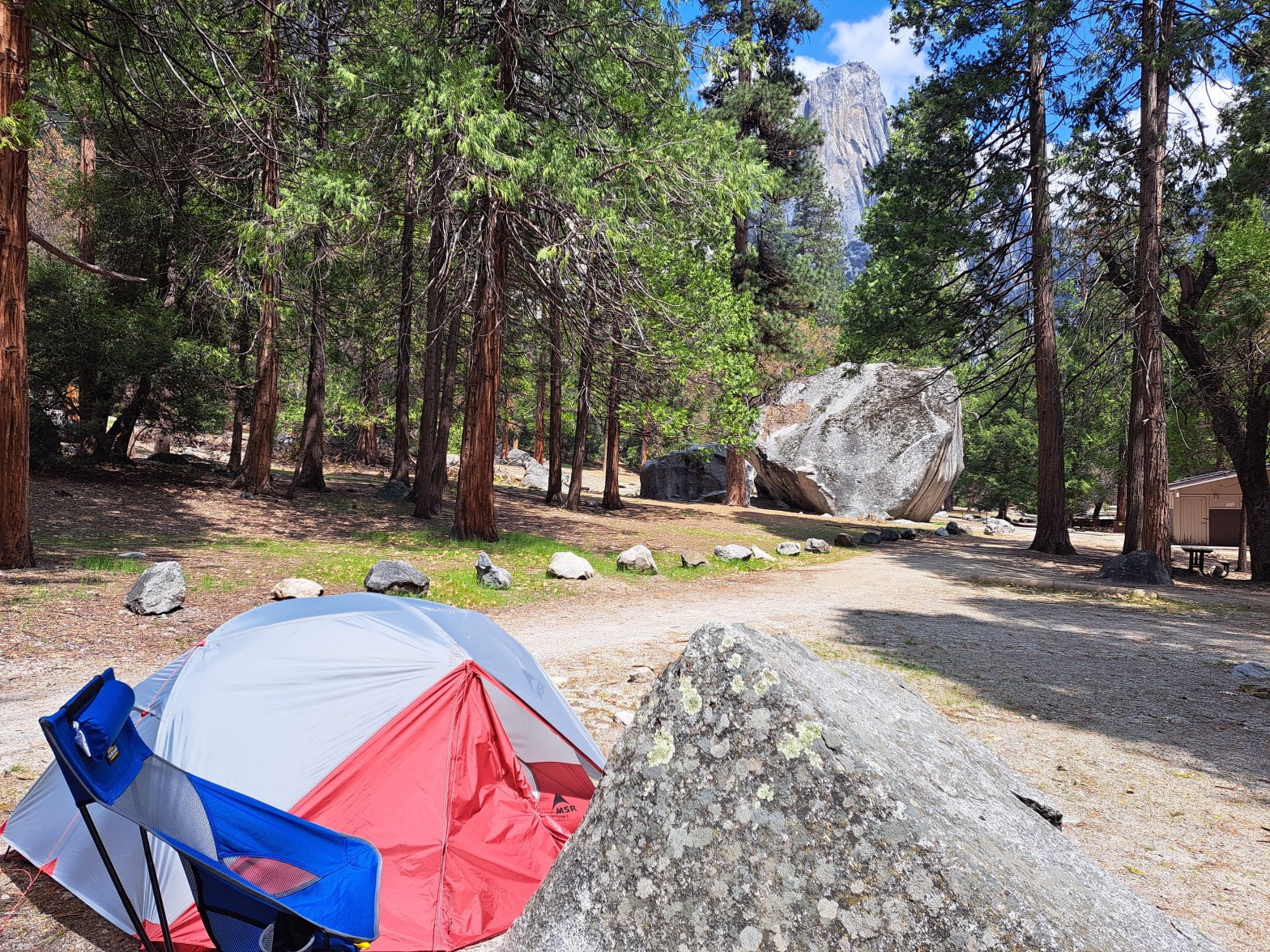
While I was camping at Upper Pines, I heard that Camp 4 was about to go back to an online reservation system.
Camp 4 with Upper Yosemite Fall in background
At this point, I’d been a little intimidated by figuring out how the off-season ‘first come first serve’ system worked. Making online reservations sounded easier to me.
Reserving a spot at Camp 4 was nowhere near as difficult as I expected it to be. As it turned out, this campground didn’t even start filling to capacity until early May.
Ephemeral waterfall behind Camp 4
Because Camp 4 is a walk in, tent only, group campsite, it functions very differently from any of the other campsites in Yosemite Valley.
All of the campsites are shared, and can accommodate up to six people. Meaning, if you go by yourself, you might be sharing a campsite with five strangers.
On the other hand, if the campground is mostly empty, you might still get your own site.
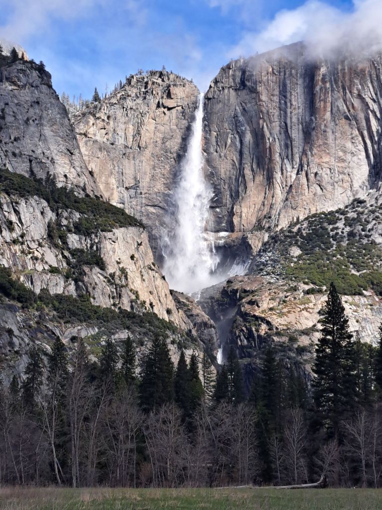
Yosemite Falls during a snowfall, as seen from Falls View, less than one mile from Camp 4
Individual campsite arrangements are configured, assigned, and inspected by the volunteer camp hosts who staff the kiosks.
Most of the people who shared my campsite were friendly. My favorite campsite mates were a father and daughter from Utah who were visiting a bunch of national parks on their way to Coachella.
A shared camp fire at Camp 4
My least favorite campsite mates were a group of very young adults who showed up at 2am with an entire film crew.
(I bet the documentary they were creating won’t show how they woke everyone up at 2am!)
I was actually pretty irked by the fact that they did this on one of the ADA sites (but I’ll write more about that in a separate post).
Upper Yosemite Falls as seen from a Meadow near camp 4
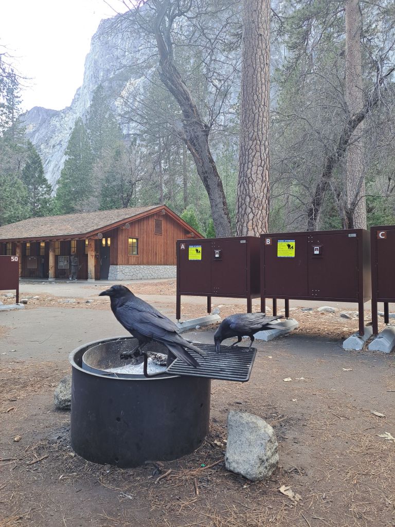
Like all campsites in Yosemite Valley, Camp 4 requires all food, toiletries, and scented items to be stored in the provided bear-proof lockers (aka bear boxes).
Each campsite has four bear boxes, which can become very noisy late at night (if they are repeatedly slammed shut). After my first night, I learned not to pitch my tent anywhere near them.
Crows waiting for scraps at Camp 4, with bear boxes behind them
Each campsite at Camp 4 has at least one picnic table (but most have two or three) and at least two fire rings.
Camp 4 is directly across the street from Yosemite Valley Lodge, where there is a shuttle stop that can take you anywhere in the valley.
The Valley Loop Trail runs behind Camp 4, which is located between the trails for Lower and Upper Yosemite Falls.
Upper and Middle Yosemite Falls as seen from a Meadow near Camp 4
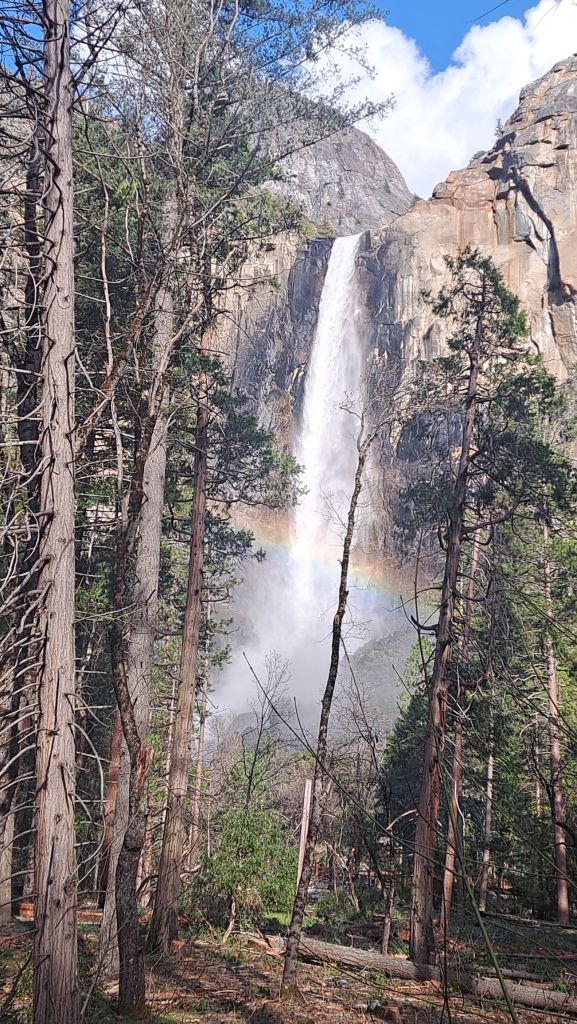
In one direction, the Trail takes you past Upper Yosemite Falls, Wahhoga Village (currently under construction), El Capitan, meadows and beaches, and Bridalveil Fall.
In the other direction, the Trail goes towards Yosemite Village, Mirror Lake, Vernal Fall, Happy Isles, and Curry Village.
Bridalveil Fall
I’ve been hiking these trails for years, but was still somewhat surprised to see so much snow around Yosemite Valley so late in April.
According to the weather report, it was supposed to start snowing by noon on the day of my check-in.
Luckily, I managed to set my tent up just on time, put my poncho on, and headed to Yosemite Falls to take videos.
A view from the drive to Mariposa, where I made a day trip for groceries
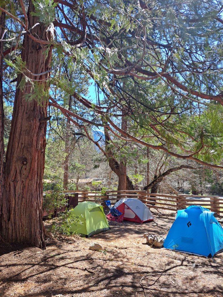
During my stay at Camp 4, I learned that strangers tend to set up camp close together, and that anything you leave out might get used by other campers.
On one specific occasion, I had set up the campsite kind of fancy to welcome my cousin.
While she and I went hiking, some German tourists showed up. They thought that the whole arrangement had been left out by camp staff to welcome them, and they used it all.
After several days, I was in need of more privacy. So, I packed up my things, and headed up to Wawona.
Showing how close strangers set up to each other at Camp 4
The best thing about Camp 4 was the price– currently only $10/person per night (not eligible for pass discounts). There is a camping limit of 14 days per year, only seven of which can be during peak season.
The worst thing about Camp 4 was the food– there was virtually no good food nearby, although there is a Starbucks at the Lodge.
Of course, Camp 4 does allow the use of personal camp stoves and camp fires, so you can always just make your own food.
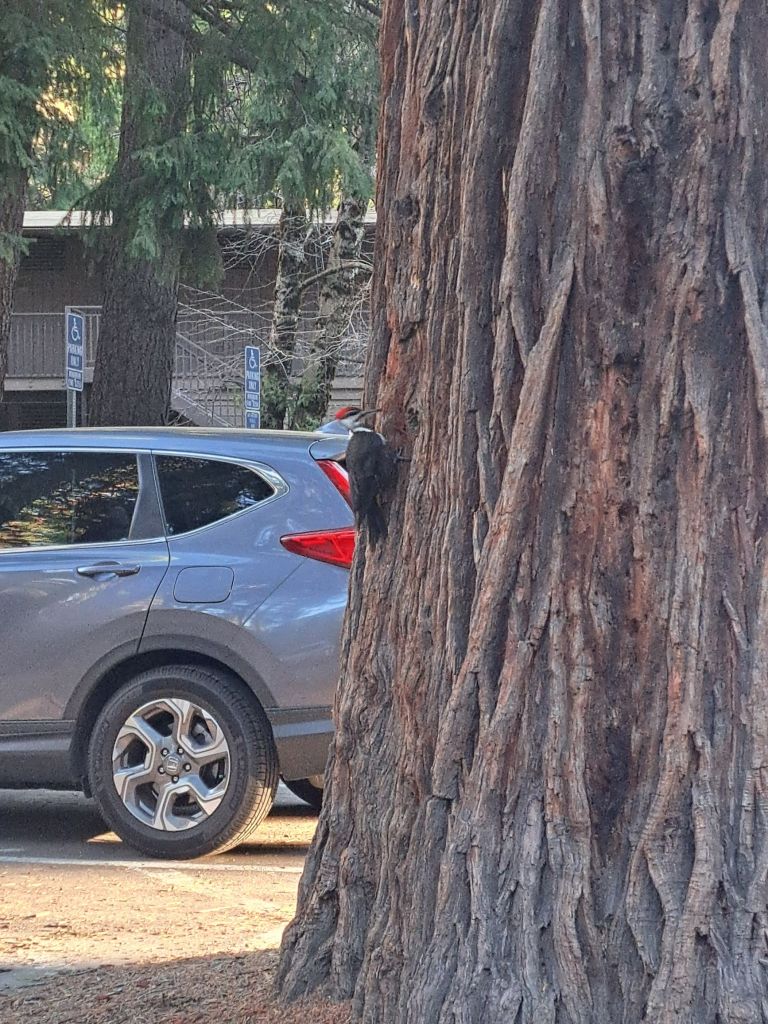
The biggest Woodpecker I’ve ever seen in my life, across the street from Camp 4 in the Yosemite Valley Lodge parking lot
My favorite thing about camping at Camp 4 was seeing all of the different ways that experienced backpackers configured their tents and sites.
I found it especially interesting to see the various ways that everyone guyed out their tents during the snowstorm.
Some people slept in hammocks or bivys
Because Camp 4 is so famous in backpacker culture, it tends to receive a lot more foot traffic from tourists than other campgrounds in the valley do.
Even though there were signs up saying “no picnicking” and “campers only,” these signs were ignored by literally hundreds of people per day.
Every single time I left my tablecloth out, it had food crumbs on it when I came back. On one occasion, I actually caught British tourists going through my bear box!
Overall, you get what you pay for. Camp 4 is nowhere near as glamorous as any of the other places you could stay in Yosemite, but it is a lot of fun.
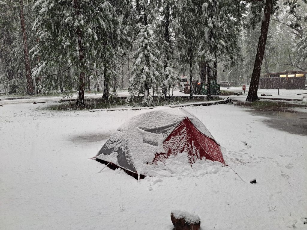
Tent getting covered in snow in early May at Upper Pines
I was sitting in the Ikea parking lot, dreading going back to the homeless shelter when I thought, what if I just went camping for a little while?
(Due to my disability, I receive some massive discounts on camping.)
The environment at the shelter was so chaotic that I couldn’t even sleep, let alone apply for jobs or housing. Maybe in Yosemite, I could at least get some rest, make some phone calls, and take care of some business.
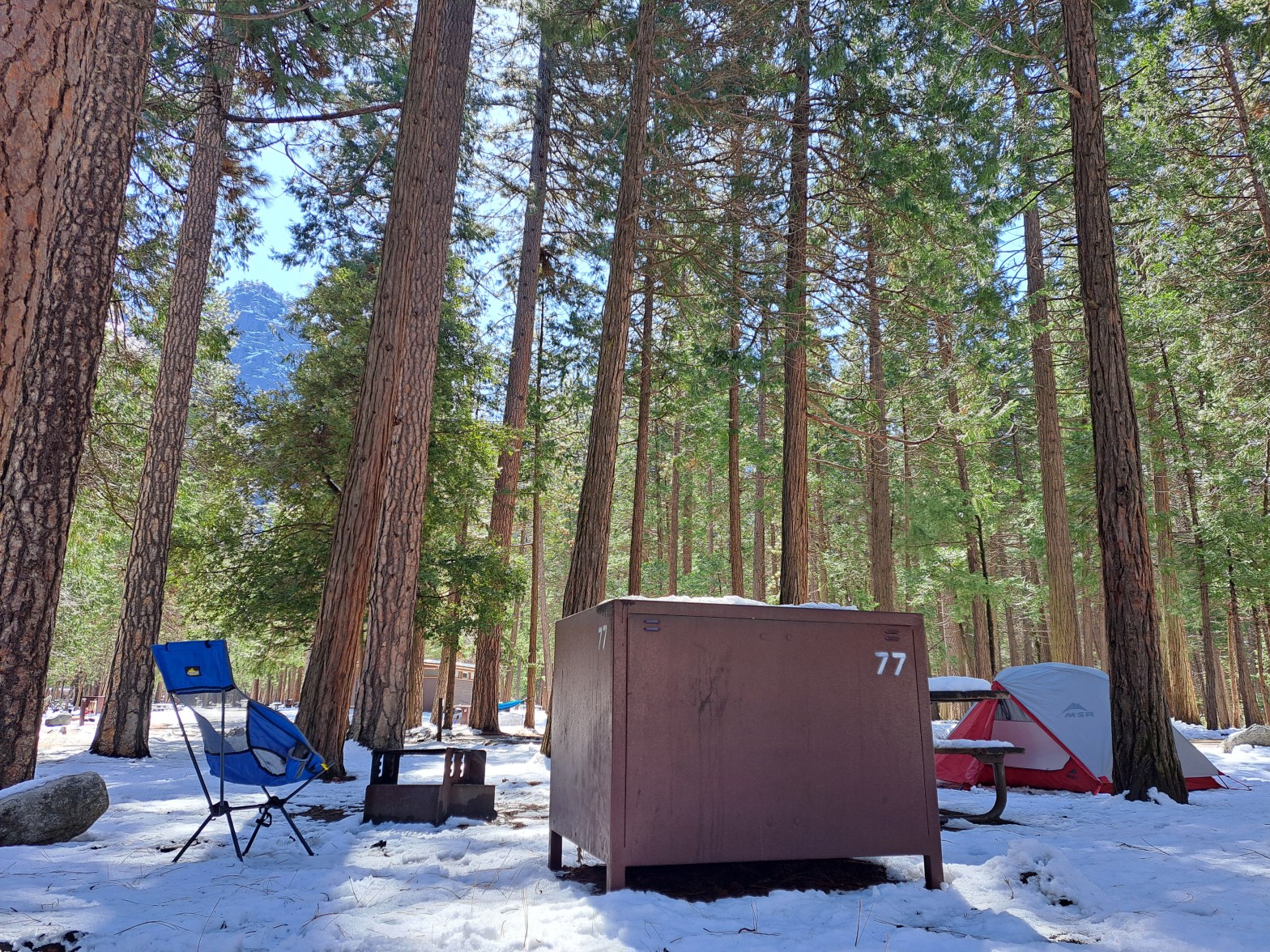
Upper Pines site 77 with snow on the ground
I checked the online reservation page for Upper Pines Campground in Yosemite, and just so happened to refresh the page at the exact same moment that someone else canceled their reservation.
It felt kind of meant to be.
I jumped on the opportunity, and booked as many nights as I could. Next thing I knew (after checking the weather), I was asking the staff at REI for advice on how to tent camp in the snow.
What I loved most about camping at Upper Pines was how close it is to Curry Village. It’s only about a five minute walk, two minute bike ride, or one shuttle stop away.
Pizza from the Pizza Deck in Curry Village
Some of the best food in Yosemite Valley is in Curry Village. After a few days of tuna, beef jerky, and trail mix, a pizza from the Pizza Deck starts to sound really good.
During my first few nights in Yosemite, I managed to find more cancelations for Upper Pines. Apparently, some people don’t like the idea of camping in the snow.
I was just glad to be out of the shelter!
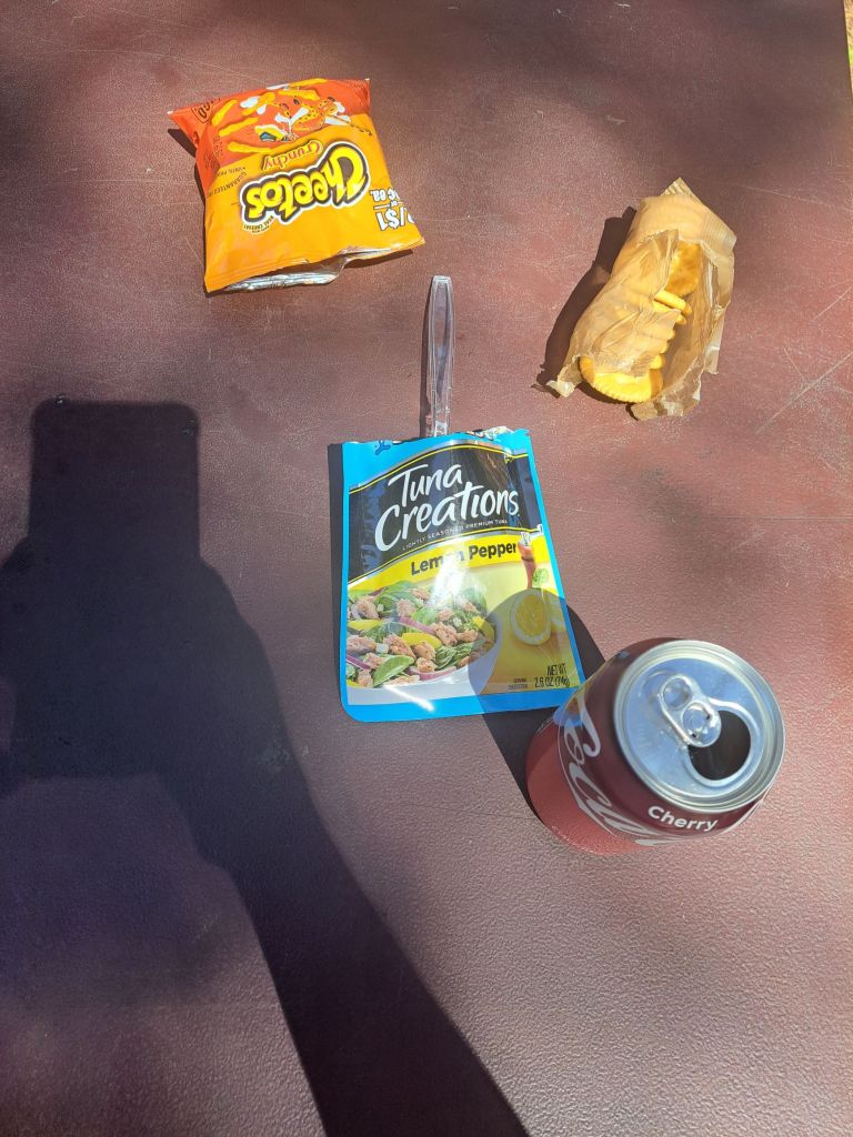
Prime nutrition: tuna, crackers, Cheetos, and cherry coke
The spaces at Upper Pines are medium sized. Some could probably fit two or three family sized tents. A lot of people bring RVs or trailers to this campground.
The noise level was not too bad. I found it to be quieter than Camp 4, but less quiet than Wawona (both of which I will write about in upcoming posts).
My first neighbor at Upper Pines was a high school counselor from San Francisco who was about my age, and also happened to be an experienced backpacker. It was fun swapping stories and tips with him.
A lot of the people who camp at Upper Pines come to the same site every year. Many are older couples who know the Valley very well.
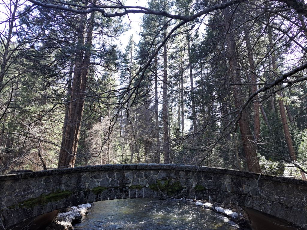
Stoneman Bridge, which is a short walk away from Upper Pines
During one of my site changes, I messed up, and failed to clear my campsite by noon. When I came back at 12:09, a ranger was there waiting for me.
“Next time,” he said, “Pack up early, park in Curry Village, and then you don’t have to worry about being back by a certain time.”
There weren’t any showers, electrical outlets, or laundry facilities at Upper Pines, but I found all of these nearby at Curry Village and Housekeeping Camp.
The regular price for a night at Upper Pines is currently $36, which is a little pricey for a tent only campsite, but is still much cheaper than staying at Curry Village or a hotel.
All of the sites at Upper Pines come with car parking spaces, bear boxes, picnic tables, and fire rings. Restrooms and dumping stations are shared.
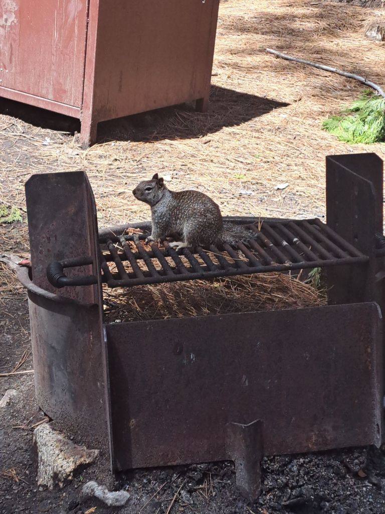
A ground squirrel snacking on whatever was left burned onto the griddle by the previous campers
Fires are allowed from 5-10pm. Firewood must be purchased at one of the village stores for $10/bundle. (If you are caught bringing in outside firewood or gathering in the park, you could get a ticket.)
The nearest trail to Upper Pines is the Valley Loop Trail, which leads to Mirror Lake, Yosemite Village, and Yosemite Falls in one direction, or Curry Village, Housekeeping Camp, the 4 Mile Trail, and Bridalveil Fall in the other direction.
I loved staying at Upper Pines, and would definitely camp here again.
My first attempt at smores: definitely did not nail it